

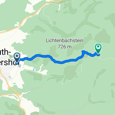
Heidenstein 53, Floh-Seligenthal nach Straße ohne Straßennamen, Floh-Seligenthal
A cycling route starting in Rotterode, Free State of Thuringia, Germany.
Overview
About this route
- 50 min
- Duration
- 3.5 km
- Distance
- 276 m
- Ascent
- 0 m
- Descent
- 4.2 km/h
- Avg. speed
- 781 m
- Avg. speed

Route quality
Waytypes & surfaces along the route
Waytypes
Track
2.5 km
(72 %)
Path
1 km
(28 %)
Surfaces
Unpaved
1 km
(28 %)
Unpaved (undefined)
0.8 km
(21 %)
Gravel
0.2 km
(6 %)
Undefined
2.5 km
(72 %)
Continue with Bikemap
Use, edit, or download this cycling route
You would like to ride Heidenstein 53, Floh-Seligenthal nach Straße ohne Straßennamen, Floh-Seligenthal or customize it for your own trip? Here is what you can do with this Bikemap route:
Free features
- Save this route as favorite or in collections
- Copy & plan your own version of this route
- Sync your route with Garmin or Wahoo
Premium features
Free trial for 3 days, or one-time payment. More about Bikemap Premium.
- Navigate this route on iOS & Android
- Export a GPX / KML file of this route
- Create your custom printout (try it for free)
- Download this route for offline navigation
Discover more Premium features.
Get Bikemap PremiumFrom our community
Other popular routes starting in Rotterode
 Rotterode-Erfurt 95 km
- Distance
- 90.2 km
- Ascent
- 597 m
- Descent
- 929 m
- Location
- Rotterode, Free State of Thuringia, Germany
 Heidenstein 53, Floh-Seligenthal nach Straße ohne Straßennamen, Floh-Seligenthal
- Distance
- 3.5 km
- Ascent
- 276 m
- Descent
- 0 m
- Location
- Rotterode, Free State of Thuringia, Germany
 Heidenstein 39, Floh-Seligenthal nach An den Birken 2, Floh-Seligenthal
- Distance
- 11.6 km
- Ascent
- 282 m
- Descent
- 323 m
- Location
- Rotterode, Free State of Thuringia, Germany
 Straße ohne Straßennamen, Floh-Seligenthal nach Kirchweg 47, Floh-Seligenthal
- Distance
- 2.4 km
- Ascent
- 0 m
- Descent
- 160 m
- Location
- Rotterode, Free State of Thuringia, Germany
 Tambach-Friedrichroda
- Distance
- 62 km
- Ascent
- 950 m
- Descent
- 950 m
- Location
- Rotterode, Free State of Thuringia, Germany
 An den Birken 2, Floh-Seligenthal nach An den Birken 2, Floh-Seligenthal
- Distance
- 15.1 km
- Ascent
- 402 m
- Descent
- 449 m
- Location
- Rotterode, Free State of Thuringia, Germany
 Rotterode-Wachsenrasen-Oberschönau (11 km)
- Distance
- 11.1 km
- Ascent
- 286 m
- Descent
- 365 m
- Location
- Rotterode, Free State of Thuringia, Germany
 Von Floh-Seligenthal bis Eiterfeld
- Distance
- 78.3 km
- Ascent
- 531 m
- Descent
- 678 m
- Location
- Rotterode, Free State of Thuringia, Germany
Open it in the app