

Taubensuhl
A cycling route starting in Landau, Rhineland-Palatinate, Germany.
Overview
About this route
Parkplatz:
Landau Horstring
B 49.20969 L8.14046
Von Landau den Quaichweg bis Albersweiler dannach rechts am Steinbruch vorbei nach Eußerthal (fangfrische Forellen!).Jetzt gehts hoch auf 540m zum Taubensuhl. Auf der
Forststraße weiter (2 km westl. dann nördl) ins Wellbachthal B 48 scharf links flott in südl.richtung abwärts. Bei Rinnthal wieder an der Quaich(alte B 10) über Annweiler (Altstadt mit Wasserräder),zum Ausgangspunkt.
- -:--
- Duration
- 62.6 km
- Distance
- 435 m
- Ascent
- 435 m
- Descent
- ---
- Avg. speed
- ---
- Avg. speed

Route quality
Waytypes & surfaces along the route
Waytypes
Busy road
18.9 km
(30 %)
Quiet road
16.5 km
(26 %)
Surfaces
Paved
55.8 km
(89 %)
Unpaved
4.1 km
(6 %)
Asphalt
54.6 km
(87 %)
Gravel
4.1 km
(6 %)
Route highlights
Points of interest along the route
Point of interest after 2 km
Landau :Gartenstadt ,Jugendstiel und Festung
Point of interest after 16.6 km
Wasserrad-kleines Kraftwerk: http://www.annweiler.de/index.cfm?fuseaction=gaeste&rubrik=trifelsburg
Point of interest after 38.8 km
Taubensuhl:http://www.quaeldich.de/paesse/taubensuhl/?lang=en
Point of interest after 44.8 km
Fangfrische Forellen
Continue with Bikemap
Use, edit, or download this cycling route
You would like to ride Taubensuhl or customize it for your own trip? Here is what you can do with this Bikemap route:
Free features
- Save this route as favorite or in collections
- Copy & plan your own version of this route
- Sync your route with Garmin or Wahoo
Premium features
Free trial for 3 days, or one-time payment. More about Bikemap Premium.
- Navigate this route on iOS & Android
- Export a GPX / KML file of this route
- Create your custom printout (try it for free)
- Download this route for offline navigation
Discover more Premium features.
Get Bikemap PremiumFrom our community
Other popular routes starting in Landau
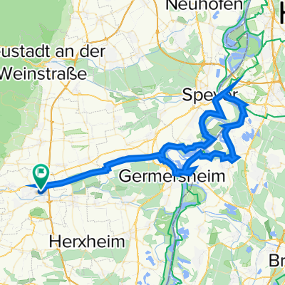 Landau - Speyer - Philipsburg - Germersheim - Landau
- Distance
- 83 km
- Ascent
- 74 m
- Descent
- 75 m
- Location
- Landau, Rhineland-Palatinate, Germany
 Rund um Landau
- Distance
- 53.1 km
- Ascent
- 201 m
- Descent
- 201 m
- Location
- Landau, Rhineland-Palatinate, Germany
 Pfälzer Wald
- Distance
- 7.6 km
- Ascent
- 80 m
- Descent
- 12 m
- Location
- Landau, Rhineland-Palatinate, Germany
 Landau HBF zum Trifels und zurück
- Distance
- 26.2 km
- Ascent
- 339 m
- Descent
- 329 m
- Location
- Landau, Rhineland-Palatinate, Germany
 D Rheinland-Pfalz Landau (West) RR über Klingenmünster und Herxheim zurück 045km
- Distance
- 45.4 km
- Ascent
- 196 m
- Descent
- 198 m
- Location
- Landau, Rhineland-Palatinate, Germany
 Burg Trifels Ruine Neukastel
- Distance
- 38.5 km
- Ascent
- 511 m
- Descent
- 510 m
- Location
- Landau, Rhineland-Palatinate, Germany
 Landauer Hütte
- Distance
- 28.4 km
- Ascent
- 447 m
- Descent
- 447 m
- Location
- Landau, Rhineland-Palatinate, Germany
 Erste Tour Landau
- Distance
- 24.9 km
- Ascent
- 115 m
- Descent
- 115 m
- Location
- Landau, Rhineland-Palatinate, Germany
Open it in the app