

Edenkoben-Modenbachtal-Kalmit-Hambacher Schloß
A cycling route starting in Edenkoben, Rhineland-Palatinate, Germany.
Overview
About this route
Eine schöne Route am Rande vom Pfälzerwald.
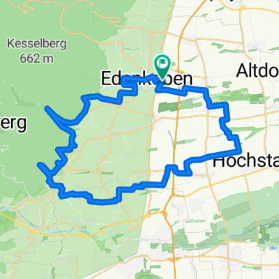
Gestartet wird am Ortseingang von Edenkoben über Triefenbachtal Richtung Modenbachtal-Weyher wieder Richtung Edenkoben.
Dann geht es weiter über St.Martin auf den Aussichtspunkt Kalmit. Dann wieder runter Richtung Maikammer. Dann geht es weiter Richtung Neustadt Weinstraße zum Ortsteil Hambach. Hier geht es dann hoch zum Hambacher Schloß.
Die Tour endet dann am Bahnhof Neustadt/Weinstraße.
Eine wirklich sehr schöne Tour, die sehr Anspruchsvoll mit den Steigungen ist. Es gibt aber auch schöne Abfahrten die zum Erholen einladen. Diese Tour ist auch sehr schön zum Motorrad fahren geeignet, wenn ich das am Rande erwähnen darf.
Viel Spass beim erkunden :-)
- -:--
- Duration
- 52.1 km
- Distance
- 1,033 m
- Ascent
- 1,034 m
- Descent
- ---
- Avg. speed
- ---
- Avg. speed
Route quality
Waytypes & surfaces along the route
Waytypes
Busy road
24.4 km
(47 %)
Quiet road
15.7 km
(30 %)
Surfaces
Paved
48.4 km
(93 %)
Unpaved
0.7 km
(1 %)
Asphalt
48.4 km
(93 %)
Ground
0.7 km
(1 %)
Continue with Bikemap
Use, edit, or download this cycling route
You would like to ride Edenkoben-Modenbachtal-Kalmit-Hambacher Schloß or customize it for your own trip? Here is what you can do with this Bikemap route:
Free features
- Save this route as favorite or in collections
- Copy & plan your own version of this route
- Sync your route with Garmin or Wahoo
Premium features
Free trial for 3 days, or one-time payment. More about Bikemap Premium.
- Navigate this route on iOS & Android
- Export a GPX / KML file of this route
- Create your custom printout (try it for free)
- Download this route for offline navigation
Discover more Premium features.
Get Bikemap PremiumFrom our community
Other popular routes starting in Edenkoben
 slt
slt- Distance
- 27.9 km
- Ascent
- 603 m
- Descent
- 603 m
- Location
- Edenkoben, Rhineland-Palatinate, Germany
 Radtour 25.03.2017
- Distance
- 53.9 km
- Ascent
- 117 m
- Descent
- 118 m
- Location
- Edenkoben, Rhineland-Palatinate, Germany
 Mandelblüten & Störche - eine Frühlingsradtour - Mandelblüten & Störche - eine Frühlingsradtour
- Distance
- 29.6 km
- Ascent
- 221 m
- Descent
- 221 m
- Location
- Edenkoben, Rhineland-Palatinate, Germany
 Radtour 09.09.2014
- Distance
- 38.3 km
- Ascent
- 259 m
- Descent
- 259 m
- Location
- Edenkoben, Rhineland-Palatinate, Germany
 Friedensdenkmal Rundtour
- Distance
- 15.9 km
- Ascent
- 475 m
- Descent
- 450 m
- Location
- Edenkoben, Rhineland-Palatinate, Germany
 Bad Dürkheim 2
- Distance
- 62.2 km
- Ascent
- 227 m
- Descent
- 229 m
- Location
- Edenkoben, Rhineland-Palatinate, Germany
 Edenkoben
- Distance
- 42.7 km
- Ascent
- 625 m
- Descent
- 623 m
- Location
- Edenkoben, Rhineland-Palatinate, Germany
 Rund um Edenkoben
- Distance
- 42.8 km
- Ascent
- 360 m
- Descent
- 360 m
- Location
- Edenkoben, Rhineland-Palatinate, Germany
Open it in the app