

2024 Tumult Köln-Fischbach-Köln
A cycling route starting in Poll, North Rhine-Westphalia, Germany.
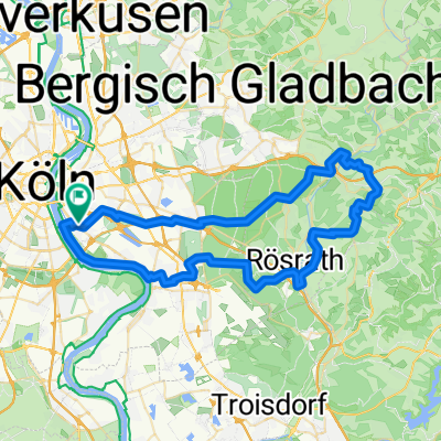
Overview
About this route
Zum TUMULT 7.-9.Juni 2024 in die Südeifel. Zeltgepäck und Zeug für drei Tage Festival. Nachts um eins los, damit ich entspannt vor dem Reisebus gegen 13h da bin um mein Zelt günstig aufbauen zu können. Bis nach Euskirchen pfeilschnell, auch Münstereifel war nicht so schlimm wie in Erinnerung. Aber dann… In Prüm habe ich schon das zweite mal Rührei nachgefüllt. Und dann gings nochmal richtig zur Sache. Drei Tage später mit etwas weniger Gepäck wieder zurück. Morgens um acht los, entspannt gefahren und extrem fit angekommen.
- 10 h 57 min
- Duration
- 163.2 km
- Distance
- 2,037 m
- Ascent
- 1,704 m
- Descent
- 14.9 km/h
- Avg. speed
- 586 m
- Avg. speed

Route quality
Waytypes & surfaces along the route
Waytypes
Quiet road
46.3 km
(28 %)
Path
44.7 km
(27 %)
Surfaces
Paved
123 km
(75 %)
Unpaved
8.1 km
(5 %)
Asphalt
109.5 km
(67 %)
Paved (undefined)
7.4 km
(5 %)
Continue with Bikemap
Use, edit, or download this cycling route
You would like to ride 2024 Tumult Köln-Fischbach-Köln or customize it for your own trip? Here is what you can do with this Bikemap route:
Free features
- Save this route as favorite or in collections
- Copy & plan your own version of this route
- Sync your route with Garmin or Wahoo
Premium features
Free trial for 3 days, or one-time payment. More about Bikemap Premium.
- Navigate this route on iOS & Android
- Export a GPX / KML file of this route
- Create your custom printout (try it for free)
- Download this route for offline navigation
Discover more Premium features.
Get Bikemap PremiumFrom our community
Other popular routes starting in Poll
 Bergische Trainingsrunde II
- Distance
- 83 km
- Ascent
- 840 m
- Descent
- 833 m
- Location
- Poll, North Rhine-Westphalia, Germany
 Rund um Köln
- Distance
- 43.1 km
- Ascent
- 104 m
- Descent
- 108 m
- Location
- Poll, North Rhine-Westphalia, Germany
 65 Gravel Köfo Immek.Heiligenhs.Hoffngthal
- Distance
- 63.6 km
- Ascent
- 1,032 m
- Descent
- 1,031 m
- Location
- Poll, North Rhine-Westphalia, Germany
 Englischer Garten Bonn
- Distance
- 65.4 km
- Ascent
- 99 m
- Descent
- 101 m
- Location
- Poll, North Rhine-Westphalia, Germany
 Weidenweg, Cologne to Quintinsstraße, Mainz
- Distance
- 193.2 km
- Ascent
- 1,380 m
- Descent
- 1,328 m
- Location
- Poll, North Rhine-Westphalia, Germany
 RTF Rodenkirchen
- Distance
- 146.3 km
- Ascent
- 1,168 m
- Descent
- 1,136 m
- Location
- Poll, North Rhine-Westphalia, Germany
 Poll-Hohkeppel-Altenrath-Poll
- Distance
- 74.5 km
- Ascent
- 289 m
- Descent
- 291 m
- Location
- Poll, North Rhine-Westphalia, Germany
 Oberländer Ufer 1, Köln nach Vogtstraße 22, Rheinbrohl
- Distance
- 271.8 km
- Ascent
- 1,613 m
- Descent
- 1,598 m
- Location
- Poll, North Rhine-Westphalia, Germany
Open it in the app