

Entlang der Schwäbischen Alb-Bahn
A cycling route starting in Münsingen, Baden-Württemberg, Germany.
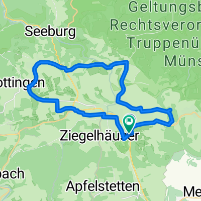
Overview
About this route
Ausgangspunkt dieser Tagestour ist Ulm. Man startet mit dem "Ulmer-Spatz" (www.albbahn.de) nach Münsingen. Von dort aus geht es die Albbahn entlang bis Schmiechen. Ab Schmiechen folgt man dem Donauradwanderweg bis Ulm. Streckenweise sind die Karten nicht mehr aktuell, da viel neu gebaut wurde, speziell in Blaubeuren und Ulm.
- -:--
- Duration
- 50.1 km
- Distance
- 725 m
- Ascent
- 946 m
- Descent
- ---
- Avg. speed
- 764 m
- Avg. speed
Route quality
Waytypes & surfaces along the route
Waytypes
Track
18.3 km
(37 %)
Quiet road
14 km
(28 %)
Surfaces
Paved
36.6 km
(73 %)
Unpaved
6.1 km
(12 %)
Asphalt
35.6 km
(71 %)
Loose gravel
4.4 km
(9 %)
Continue with Bikemap
Use, edit, or download this cycling route
You would like to ride Entlang der Schwäbischen Alb-Bahn or customize it for your own trip? Here is what you can do with this Bikemap route:
Free features
- Save this route as favorite or in collections
- Copy & plan your own version of this route
- Sync your route with Garmin or Wahoo
Premium features
Free trial for 3 days, or one-time payment. More about Bikemap Premium.
- Navigate this route on iOS & Android
- Export a GPX / KML file of this route
- Create your custom printout (try it for free)
- Download this route for offline navigation
Discover more Premium features.
Get Bikemap PremiumFrom our community
Other popular routes starting in Münsingen
 Buchbare Tour 4 | 2. Tag
- Distance
- 10.8 km
- Ascent
- 196 m
- Descent
- 195 m
- Location
- Münsingen, Baden-Württemberg, Germany
 e-Bike Tour 3 / Gruorn und Trailfinger Schlucht
- Distance
- 41.8 km
- Ascent
- 693 m
- Descent
- 693 m
- Location
- Münsingen, Baden-Württemberg, Germany
 Buchbare Tour 4 | 4. Tag Variante 2
- Distance
- 21.6 km
- Ascent
- 262 m
- Descent
- 260 m
- Location
- Münsingen, Baden-Württemberg, Germany
 50 Samstag 2025
- Distance
- 50 km
- Ascent
- 611 m
- Descent
- 610 m
- Location
- Münsingen, Baden-Württemberg, Germany
 Von Münsingen bis Gomadingen
- Distance
- 8.7 km
- Ascent
- 128 m
- Descent
- 256 m
- Location
- Münsingen, Baden-Württemberg, Germany
 Buchbare Tour 4 | 4. Tag Variante 1
- Distance
- 8 km
- Ascent
- 145 m
- Descent
- 141 m
- Location
- Münsingen, Baden-Württemberg, Germany
 Alb Gold Tour
- Distance
- 67 km
- Ascent
- 627 m
- Descent
- 626 m
- Location
- Münsingen, Baden-Württemberg, Germany
 Über die Albhöhen ins Lautertal
- Distance
- 38.4 km
- Ascent
- 665 m
- Descent
- 680 m
- Location
- Münsingen, Baden-Württemberg, Germany
Open it in the app