

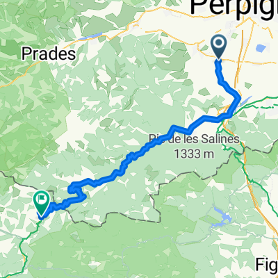
COL DE FORTOU/ COLL D'EN FORTÓ (por Fourques)
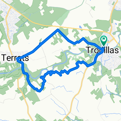
A cycling route starting in Trouillas, Languedoc-Roussillon-Midi-Pyrénées, France.
Overview
About this route
- 1 h 46 min
- Duration
- 19.8 km
- Distance
- 857 m
- Ascent
- 350 m
- Descent
- 11.3 km/h
- Avg. speed
- 645 m
- Avg. speed

Route photos
\"")
Route quality
Waytypes & surfaces along the route
Waytypes
Road
11.2 km
(57 %)
Busy road
7.3 km
(37 %)
Surfaces
Paved
18.3 km
(92 %)
Unpaved
0.4 km
(2 %)
Asphalt
18.3 km
(92 %)
Gravel
0.3 km
(1 %)
Continue with Bikemap
Use, edit, or download this cycling route
You would like to ride COL DE FORTOU/ COLL D'EN FORTÓ (por Fourques) or customize it for your own trip? Here is what you can do with this Bikemap route:
Free features
- Save this route as favorite or in collections
- Copy & plan your own version of this route
- Sync your route with Garmin or Wahoo
Premium features
Free trial for 3 days, or one-time payment. More about Bikemap Premium.
- Navigate this route on iOS & Android
- Export a GPX / KML file of this route
- Create your custom printout (try it for free)
- Download this route for offline navigation
Discover more Premium features.
Get Bikemap PremiumFrom our community
Other popular routes starting in Trouillas
 25 Lotissement l'Orée des Chênes, Trouillas à 29 Avenue du Monestir, Trouillas
- Distance
- 4.1 km
- Ascent
- 48 m
- Descent
- 32 m
- Location
- Trouillas, Languedoc-Roussillon-Midi-Pyrénées, France
 Trouillas-Molló
- Distance
- 77.1 km
- Ascent
- 1,514 m
- Descent
- 442 m
- Location
- Trouillas, Languedoc-Roussillon-Midi-Pyrénées, France
 Recovered Route
- Distance
- 27.3 km
- Ascent
- 213 m
- Descent
- 269 m
- Location
- Trouillas, Languedoc-Roussillon-Midi-Pyrénées, France
 Avenue de la San Joan (Trouillas) - Leucate (11370), Aude, Occitanie, France
- Distance
- 60.2 km
- Ascent
- 96 m
- Descent
- 168 m
- Location
- Trouillas, Languedoc-Roussillon-Midi-Pyrénées, France
 De Avenue Canterrane 23, Trouillas à Avenue Canterrane 25, Trouillas
- Distance
- 9.4 km
- Ascent
- 159 m
- Descent
- 156 m
- Location
- Trouillas, Languedoc-Roussillon-Midi-Pyrénées, France
 COL DE FORTOU/ COLL D'EN FORTÓ (por Fourques)
- Distance
- 19.8 km
- Ascent
- 857 m
- Descent
- 350 m
- Location
- Trouillas, Languedoc-Roussillon-Midi-Pyrénées, France
 27 Avenue du Monestir, Trouillas à 26 Lotissement l'Orée des Chênes, Trouillas
- Distance
- 9.7 km
- Ascent
- 94 m
- Descent
- 109 m
- Location
- Trouillas, Languedoc-Roussillon-Midi-Pyrénées, France
 De Rue des Caves 1, Trouillas à Traverse de Thuir, Trouillas
- Distance
- 16.5 km
- Ascent
- 103 m
- Descent
- 92 m
- Location
- Trouillas, Languedoc-Roussillon-Midi-Pyrénées, France
Open it in the app