

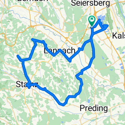
UP-Feldkirchen-Graz-Thal/Eben-Steinberg-Hitzendorf-Doblegg-Tobelbad-Dobl-Zwaring-Wundschuh-SFZ
A cycling route starting in Unterpremstätten, Styria, Austria.
Overview
About this route
ridden on: 10.04.2012
pure riding time: 2:38:00
conditionally suitable for racing bikes (poor road surface/gravel section between Tobelbad and Dobl
mostly on low-traffic country roads and municipal roads, as well as on bike paths
more suitable for trekking bikes and mountain bikes
- -:--
- Duration
- 64.8 km
- Distance
- 420 m
- Ascent
- 438 m
- Descent
- ---
- Avg. speed
- ---
- Max. altitude

Route quality
Waytypes & surfaces along the route
Waytypes
Quiet road
28.5 km
(44 %)
Road
9.1 km
(14 %)
Surfaces
Paved
31.1 km
(48 %)
Unpaved
3.2 km
(5 %)
Asphalt
29.8 km
(46 %)
Unpaved (undefined)
1.9 km
(3 %)
Continue with Bikemap
Use, edit, or download this cycling route
You would like to ride UP-Feldkirchen-Graz-Thal/Eben-Steinberg-Hitzendorf-Doblegg-Tobelbad-Dobl-Zwaring-Wundschuh-SFZ or customize it for your own trip? Here is what you can do with this Bikemap route:
Free features
- Save this route as favorite or in collections
- Copy & plan your own version of this route
- Sync your route with Garmin or Wahoo
Premium features
Free trial for 3 days, or one-time payment. More about Bikemap Premium.
- Navigate this route on iOS & Android
- Export a GPX / KML file of this route
- Create your custom printout (try it for free)
- Download this route for offline navigation
Discover more Premium features.
Get Bikemap PremiumFrom our community
Other popular routes starting in Unterpremstätten
 UP-Feldkirchen-Graz-Thal/Eben-Steinberg-Hitzendorf-Doblegg-Tobelbad-Dobl-Zwaring-Wundschuh-SFZ
- Distance
- 64.8 km
- Ascent
- 420 m
- Descent
- 438 m
- Location
- Unterpremstätten, Styria, Austria
 Schwarzlsee - Wildon - Kirchberg - St. Margarethen - Nestelbach - Schwarzlsee
- Distance
- 88.4 km
- Ascent
- 946 m
- Descent
- 953 m
- Location
- Unterpremstätten, Styria, Austria
 Steiermark 3 - Südliche Mur
- Distance
- 76.7 km
- Ascent
- 172 m
- Descent
- 176 m
- Location
- Unterpremstätten, Styria, Austria
 Südsteiermark
- Distance
- 90.1 km
- Ascent
- 528 m
- Descent
- 636 m
- Location
- Unterpremstätten, Styria, Austria
 Glocknerman 2014
- Distance
- 1,054.8 km
- Ascent
- 7,201 m
- Descent
- 7,201 m
- Location
- Unterpremstätten, Styria, Austria
 Südwestliche West-STEIERMARK 1
- Distance
- 63.9 km
- Ascent
- 437 m
- Descent
- 440 m
- Location
- Unterpremstätten, Styria, Austria
 Bike Graz 70.3 v003
- Distance
- 89.3 km
- Ascent
- 1,281 m
- Descent
- 1,239 m
- Location
- Unterpremstätten, Styria, Austria
 Über die süd-westl Hügeln
- Distance
- 54 km
- Ascent
- 564 m
- Descent
- 564 m
- Location
- Unterpremstätten, Styria, Austria
Open it in the app