

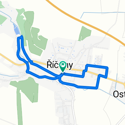
Říčky - Kralice - Mohelno - Oslavany - Zbýšov - Ostrovačice - Komín - Kuřim
A cycling route starting in Říčany, South Moravian, Czechia.
Overview
About this route
Čím více zde napíšete informací, tím více bude užitečnější pro ostatním uživatele.* Průběh trasy.* Co je zvláštní na této trase?* Proč doporučit tuto trasu?* Co se Vám zde nejvíce líbilo?* Atd.
- -:--
- Duration
- 86.5 km
- Distance
- 665 m
- Ascent
- 802 m
- Descent
- ---
- Avg. speed
- ---
- Avg. speed
Route quality
Waytypes & surfaces along the route
Waytypes
Road
44.1 km
(51 %)
Busy road
20.2 km
(23 %)
Surfaces
Paved
54.2 km
(63 %)
Asphalt
50.9 km
(59 %)
Paved (undefined)
2.5 km
(3 %)
Continue with Bikemap
Use, edit, or download this cycling route
You would like to ride Říčky - Kralice - Mohelno - Oslavany - Zbýšov - Ostrovačice - Komín - Kuřim or customize it for your own trip? Here is what you can do with this Bikemap route:
Free features
- Save this route as favorite or in collections
- Copy & plan your own version of this route
- Sync your route with Garmin or Wahoo
Premium features
Free trial for 3 days, or one-time payment. More about Bikemap Premium.
- Navigate this route on iOS & Android
- Export a GPX / KML file of this route
- Create your custom printout (try it for free)
- Download this route for offline navigation
Discover more Premium features.
Get Bikemap PremiumFrom our community
Other popular routes starting in Říčany
 Morawy Południowe_2
- Distance
- 39.1 km
- Ascent
- 478 m
- Descent
- 416 m
- Location
- Říčany, South Moravian, Czechia
 Říčky - Kralice - Mohelno - Oslavany - Zbýšov - Ostrovačice - Komín - Kuřim
- Distance
- 86.5 km
- Ascent
- 665 m
- Descent
- 802 m
- Location
- Říčany, South Moravian, Czechia
 Rosická 141, Říčany to Rosická 141, Říčany
- Distance
- 4.3 km
- Ascent
- 42 m
- Descent
- 52 m
- Location
- Říčany, South Moravian, Czechia
 ME 2013 TT U23
- Distance
- 26.9 km
- Ascent
- 389 m
- Descent
- 390 m
- Location
- Říčany, South Moravian, Czechia
 Z Říček údolím Chvojnice, Oslavy, Jihlavy a Bobravy
- Distance
- 87.2 km
- Ascent
- 665 m
- Descent
- 665 m
- Location
- Říčany, South Moravian, Czechia
 Tour de Javůrek
- Distance
- 30.9 km
- Ascent
- 463 m
- Descent
- 463 m
- Location
- Říčany, South Moravian, Czechia
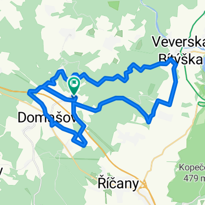
 Říčky - V. Bitýška - Veveří - žlutá - Bystrc - Farinka - Bosonohy - Troubsko
- Distance
- 39.1 km
- Ascent
- 400 m
- Descent
- 580 m
- Location
- Říčany, South Moravian, Czechia
 maraton pells
- Distance
- 58.8 km
- Ascent
- 1,104 m
- Descent
- 1,013 m
- Location
- Říčany, South Moravian, Czechia
Open it in the app