

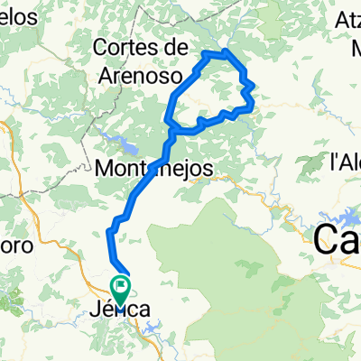
Jerica-Montanejos-Torrechiva-Torralba
A cycling route starting in Jérica, Valencia, Spain.
Overview
About this route
DATOS REALES: 89 kms - 1736 metros de desnivel
- -:--
- Duration
- 87.7 km
- Distance
- 1,360 m
- Ascent
- 1,352 m
- Descent
- ---
- Avg. speed
- ---
- Avg. speed
Route quality
Waytypes & surfaces along the route
Waytypes
Road
42.1 km
(48 %)
Busy road
32.7 km
(37 %)
Surfaces
Paved
53.2 km
(61 %)
Unpaved
0 km
(<1 %)
Asphalt
49 km
(56 %)
Concrete
4.2 km
(5 %)
Continue with Bikemap
Use, edit, or download this cycling route
You would like to ride Jerica-Montanejos-Torrechiva-Torralba or customize it for your own trip? Here is what you can do with this Bikemap route:
Free features
- Save this route as favorite or in collections
- Copy & plan your own version of this route
- Sync your route with Garmin or Wahoo
Premium features
Free trial for 3 days, or one-time payment. More about Bikemap Premium.
- Navigate this route on iOS & Android
- Export a GPX / KML file of this route
- Create your custom printout (try it for free)
- Download this route for offline navigation
Discover more Premium features.
Get Bikemap PremiumFrom our community
Other popular routes starting in Jérica
 RUTA MINA DE OJOS NEGROS, TRAMO JERICA-BARRACAS
- Distance
- 31.2 km
- Ascent
- 549 m
- Descent
- 45 m
- Location
- Jérica, Valencia, Spain
 Paisajes del Río Palancia
- Distance
- 29.1 km
- Ascent
- 407 m
- Descent
- 397 m
- Location
- Jérica, Valencia, Spain
 ESP 034: Via Verde Ojos Negros (Südabschnitt- 3. Teil)
- Distance
- 82.1 km
- Ascent
- 826 m
- Descent
- 827 m
- Location
- Jérica, Valencia, Spain
 Caudiel, Alcabaira, Maspalomas, Cerdaña, Fuensanta
- Distance
- 24 km
- Ascent
- 646 m
- Descent
- 647 m
- Location
- Jérica, Valencia, Spain
 Gaibiel-montanejos
- Distance
- 100.7 km
- Ascent
- 2,476 m
- Descent
- 2,289 m
- Location
- Jérica, Valencia, Spain
 Jérica-OF Feliciano-OF Peñas Amador
- Distance
- 56.6 km
- Ascent
- 1,163 m
- Descent
- 1,163 m
- Location
- Jérica, Valencia, Spain
 ESP 033: Via Verde Ojos Negros (Südabschnitt- 2. Teil)
- Distance
- 87.7 km
- Ascent
- 702 m
- Descent
- 702 m
- Location
- Jérica, Valencia, Spain
 Jérica-Montanejos-Villahermosa-Montanejos-Jérica
- Distance
- 112.6 km
- Ascent
- 3,534 m
- Descent
- 3,437 m
- Location
- Jérica, Valencia, Spain
Open it in the app