

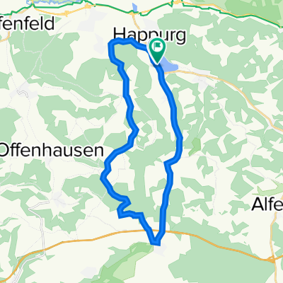
Happurg-Neukirchen-Sulzbach Rosenberg-Fürnried(56,7 km)
A cycling route starting in Happurg, Bavaria, Germany.
Overview
About this route
- -:--
- Duration
- 58.5 km
- Distance
- 992 m
- Ascent
- 991 m
- Descent
- ---
- Avg. speed
- 558 m
- Avg. speed

Route photos
\"")
\"")
\"")
Route quality
Waytypes & surfaces along the route
Waytypes
Quiet road
26.5 km
(45 %)
Road
15.8 km
(27 %)
Surfaces
Paved
40.1 km
(69 %)
Unpaved
4.5 km
(8 %)
Asphalt
39.7 km
(68 %)
Gravel
3.5 km
(6 %)
Continue with Bikemap
Use, edit, or download this cycling route
You would like to ride Happurg-Neukirchen-Sulzbach Rosenberg-Fürnried(56,7 km) or customize it for your own trip? Here is what you can do with this Bikemap route:
Free features
- Save this route as favorite or in collections
- Copy & plan your own version of this route
- Sync your route with Garmin or Wahoo
Premium features
Free trial for 3 days, or one-time payment. More about Bikemap Premium.
- Navigate this route on iOS & Android
- Export a GPX / KML file of this route
- Create your custom printout (try it for free)
- Download this route for offline navigation
Discover more Premium features.
Get Bikemap PremiumFrom our community
Other popular routes starting in Happurg
 Vom Am Baggersee in Happurg nach Velden und wieder zurück
- Distance
- 47.5 km
- Ascent
- 734 m
- Descent
- 727 m
- Location
- Happurg, Bavaria, Germany
 Radelparadies Nürnberger Land: Tour 10
- Distance
- 22 km
- Ascent
- 425 m
- Descent
- 425 m
- Location
- Happurg, Bavaria, Germany
 Happurg-Neukirchen-Sulzbach Rosenberg-Fürnried(56,7 km)
- Distance
- 58.5 km
- Ascent
- 992 m
- Descent
- 991 m
- Location
- Happurg, Bavaria, Germany
 D_Bayern_Happurger Stausee-Deckersberg-Mosenhof
- Distance
- 24 km
- Ascent
- 556 m
- Descent
- 556 m
- Location
- Happurg, Bavaria, Germany
 Hersbruck -Vorra-Hirschbach-Oed
- Distance
- 46.7 km
- Ascent
- 338 m
- Descent
- 339 m
- Location
- Happurg, Bavaria, Germany
 D_Bayern_Hohenstadt-Hersbruck-Kleedorf-Alfalter-Eschenbach_RR-16,5km-470hm
- Distance
- 16.6 km
- Ascent
- 475 m
- Descent
- 474 m
- Location
- Happurg, Bavaria, Germany
 D_Bayern_HappurgerStausee-(LR)-Förrenbach-Molsberg-Gotzenberg-Regelsmühle-Heldmannsberg
- Distance
- 25.9 km
- Ascent
- 683 m
- Descent
- 682 m
- Location
- Happurg, Bavaria, Germany
 Lichtenegg - Keilberg - Steinere Rinne - Jungfernsprung
- Distance
- 59.5 km
- Ascent
- 1,301 m
- Descent
- 1,298 m
- Location
- Happurg, Bavaria, Germany