

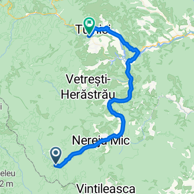
Zabala - Tulnici (Tag 6 - Radtour 2008)
A cycling route starting in Nereju Mic, Vrancea, Romania.
Overview
About this route
Beschreibung folgt !
- -:--
- Duration
- 58.7 km
- Distance
- 633 m
- Ascent
- 969 m
- Descent
- ---
- Avg. speed
- 811 m
- Avg. speed
Route quality
Waytypes & surfaces along the route
Waytypes
Busy road
48.2 km
(82 %)
Track
6.8 km
(12 %)
Surfaces
Paved
51.3 km
(87 %)
Unpaved
7 km
(12 %)
Asphalt
51.3 km
(87 %)
Unpaved (undefined)
4.2 km
(7 %)
Continue with Bikemap
Use, edit, or download this cycling route
You would like to ride Zabala - Tulnici (Tag 6 - Radtour 2008) or customize it for your own trip? Here is what you can do with this Bikemap route:
Free features
- Save this route as favorite or in collections
- Copy & plan your own version of this route
- Sync your route with Garmin or Wahoo
Premium features
Free trial for 3 days, or one-time payment. More about Bikemap Premium.
- Navigate this route on iOS & Android
- Export a GPX / KML file of this route
- Create your custom printout (try it for free)
- Download this route for offline navigation
Discover more Premium features.
Get Bikemap PremiumFrom our community
Other popular routes starting in Nereju Mic
 Zabala - Tulnici (Tag 6 - Radtour 2008)
- Distance
- 58.7 km
- Ascent
- 633 m
- Descent
- 969 m
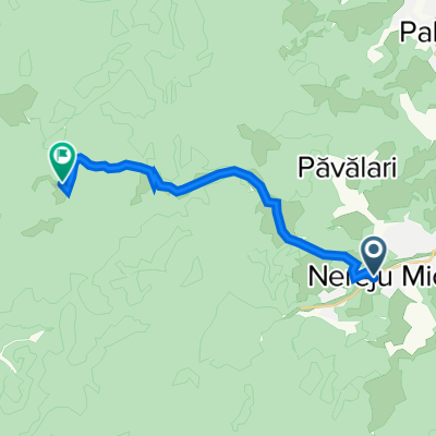
- Location
- Nereju Mic, Vrancea, Romania
 Vrancea - Zboina Frumoasa din Nereju Mic
- Distance
- 13.8 km
- Ascent
- 1,159 m
- Descent
- 81 m
- Location
- Nereju Mic, Vrancea, Romania
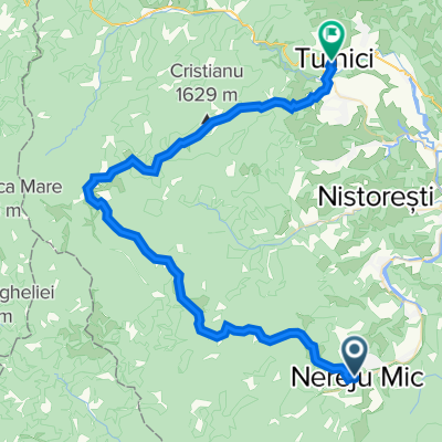 Vrancea - traseu 1 BR - Tulnici-Nereju Mic
- Distance
- 57.5 km
- Ascent
- 2,540 m
- Descent
- 2,635 m
- Location
- Nereju Mic, Vrancea, Romania
 VN1. BR Comuna Tulnici-Muntele Coza-Dealul Negru-Şaua Tişitei-Culmea Păişele –Pietrosu-Zboina Frumoasă –Culmea Lapoşul –Comuna Nereju2
- Distance
- 57.5 km
- Ascent
- 1,841 m
- Descent
- 1,936 m
- Location
- Nereju Mic, Vrancea, Romania
Open it in the app