
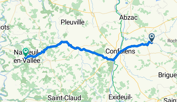
184 La Vauzelle, Brillac to 21 bis Rue Farèze, Nanteuil-en-Vallée
A cycling route starting in Confolens, Aquitaine-Limousin-Poitou-Charentes, France.
Overview
About this route
- 2 h 19 min
- Duration
- 45.1 km
- Distance
- 513 m
- Ascent
- 594 m
- Descent
- 19.4 km/h
- Avg. speed
- 231 m
- Avg. speed
Route quality
Waytypes & surfaces along the route
Waytypes
Road
32.6 km
(72 %)
Quiet road
6.3 km
(14 %)
Surfaces
Paved
16.9 km
(37 %)
Asphalt
16.6 km
(37 %)
Paving stones
0.2 km
(<1 %)
Undefined
28.2 km
(63 %)
Continue with Bikemap
Use, edit, or download this cycling route
You would like to ride 184 La Vauzelle, Brillac to 21 bis Rue Farèze, Nanteuil-en-Vallée or customize it for your own trip? Here is what you can do with this Bikemap route:
Free features
- Save this route as favorite or in collections
- Copy & plan your own version of this route
- Sync your route with Garmin or Wahoo
Premium features
Free trial for 3 days, or one-time payment. More about Bikemap Premium.
- Navigate this route on iOS & Android
- Export a GPX / KML file of this route
- Create your custom printout (try it for free)
- Download this route for offline navigation
Discover more Premium features.
Get Bikemap PremiumFrom our community
Other popular routes starting in Confolens
 Confolens to Etagnac longer
- Distance
- 76.8 km
- Ascent
- 991 m
- Descent
- 986 m
- Location
- Confolens, Aquitaine-Limousin-Poitou-Charentes, France
 Confolens to La Chapelle-Montbrandeix
- Distance
- 55.5 km
- Ascent
- 584 m
- Descent
- 329 m
- Location
- Confolens, Aquitaine-Limousin-Poitou-Charentes, France
 Confolens to Rochechouart
- Distance
- 32.9 km
- Ascent
- 320 m
- Descent
- 221 m
- Location
- Confolens, Aquitaine-Limousin-Poitou-Charentes, France
 Confolens to La Chabroulie, near Saint-Mathieu
- Distance
- 55.2 km
- Ascent
- 519 m
- Descent
- 389 m
- Location
- Confolens, Aquitaine-Limousin-Poitou-Charentes, France
 Confolence to Civray
- Distance
- 88.5 km
- Ascent
- 837 m
- Descent
- 841 m
- Location
- Confolens, Aquitaine-Limousin-Poitou-Charentes, France
 Confolens to Pressac
- Distance
- 50.2 km
- Ascent
- 447 m
- Descent
- 455 m
- Location
- Confolens, Aquitaine-Limousin-Poitou-Charentes, France
 Schweiz - Atlantik; 10. Etappe Confolens (Camping Municipal) - Bourg Charante (Camping)
- Distance
- 108.7 km
- Ascent
- 734 m
- Descent
- 828 m
- Location
- Confolens, Aquitaine-Limousin-Poitou-Charentes, France
 9 bis Rue Fontaine de Guimard, Confolens to 11 Rue Fontaine de Guimard, Confolens
- Distance
- 61 km
- Ascent
- 1,018 m
- Descent
- 1,017 m
- Location
- Confolens, Aquitaine-Limousin-Poitou-Charentes, France
Open it in the app