

XC-Strecke RLP und SAR Meisterschaft 2012
A cycling route starting in Neustadt, Rhineland-Palatinate, Germany.
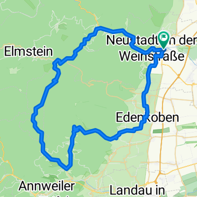
Overview
About this route
Am Samstag den 11. August 2012 werden zum dritten Mal Biker rund um den Haardter Sportplatz um die Wette fahren. Im Rahmen der Sigma XC Trophy werden die Landesverbandsmeisterschaften von Rheinland-Pfalz und Saarland ausgetragen. Alle die nicht genug vom Biken bekommen, können sich einen Tag später noch bei der 10. Austragung des SIGMA SPORT Bike Marathons austoben. Kurzum das Wochenende 11. und 12. August steht in Neustadt an der Weinstraße im Zeichen des Mountainbike Sports.
- -:--
- Duration
- 2.1 km
- Distance
- 117 m
- Ascent
- 117 m
- Descent
- ---
- Avg. speed
- ---
- Avg. speed
Route highlights
Points of interest along the route
Point of interest after 1.6 km
ab hier beginnt die Strecke für die Elite!
Continue with Bikemap
Use, edit, or download this cycling route
You would like to ride XC-Strecke RLP und SAR Meisterschaft 2012 or customize it for your own trip? Here is what you can do with this Bikemap route:
Free features
- Save this route as favorite or in collections
- Copy & plan your own version of this route
- Sync your route with Garmin or Wahoo
Premium features
Free trial for 3 days, or one-time payment. More about Bikemap Premium.
- Navigate this route on iOS & Android
- Export a GPX / KML file of this route
- Create your custom printout (try it for free)
- Download this route for offline navigation
Discover more Premium features.
Get Bikemap PremiumFrom our community
Other popular routes starting in Neustadt
 Pfalz 2015
- Distance
- 35.9 km
- Ascent
- 1,038 m
- Descent
- 1,038 m
- Location
- Neustadt, Rhineland-Palatinate, Germany
 Große Pfälzerwald Runde
- Distance
- 141.3 km
- Ascent
- 796 m
- Descent
- 798 m
- Location
- Neustadt, Rhineland-Palatinate, Germany
 Kalmit-HohenLog Tour
- Distance
- 47.2 km
- Ascent
- 1,350 m
- Descent
- 1,350 m
- Location
- Neustadt, Rhineland-Palatinate, Germany
 Neustadt - Kalmitrunde
- Distance
- 30.6 km
- Ascent
- 836 m
- Descent
- 839 m
- Location
- Neustadt, Rhineland-Palatinate, Germany
 BRT2019-So Entwurf 70km
- Distance
- 62.8 km
- Ascent
- 702 m
- Descent
- 701 m
- Location
- Neustadt, Rhineland-Palatinate, Germany
 Mußbach-Weinbiet-Totenkopfhütte-Mußbach
- Distance
- 44.8 km
- Ascent
- 873 m
- Descent
- 873 m
- Location
- Neustadt, Rhineland-Palatinate, Germany
 Weinbiet über Haardt
- Distance
- 11.6 km
- Ascent
- 424 m
- Descent
- 352 m
- Location
- Neustadt, Rhineland-Palatinate, Germany
 Kalmitrunde
- Distance
- 25.9 km
- Ascent
- 808 m
- Descent
- 808 m
- Location
- Neustadt, Rhineland-Palatinate, Germany
Open it in the app