

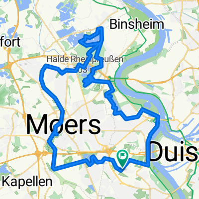
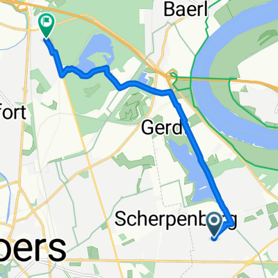
Boschheideweg 17b, Moers nach Stefanstraße 18, Moers
A cycling route starting in Moers, North Rhine-Westphalia, Germany.
Overview
About this route
- 1 h 19 min
- Duration
- 15.2 km
- Distance
- 24 m
- Ascent
- 27 m
- Descent
- 11.6 km/h
- Avg. speed
- 40 m
- Avg. speed

Route quality
Waytypes & surfaces along the route
Waytypes
Quiet road
9.3 km
(61 %)
Access road
3 km
(19 %)
Surfaces
Paved
7.7 km
(51 %)
Unpaved
0.1 km
(<1 %)
Asphalt
7.1 km
(47 %)
Paving stones
0.6 km
(4 %)
Continue with Bikemap
Use, edit, or download this cycling route
You would like to ride Boschheideweg 17b, Moers nach Stefanstraße 18, Moers or customize it for your own trip? Here is what you can do with this Bikemap route:
Free features
- Save this route as favorite or in collections
- Copy & plan your own version of this route
- Sync your route with Garmin or Wahoo
Premium features
Free trial for 3 days, or one-time payment. More about Bikemap Premium.
- Navigate this route on iOS & Android
- Export a GPX / KML file of this route
- Create your custom printout (try it for free)
- Download this route for offline navigation
Discover more Premium features.
Get Bikemap PremiumFrom our community
Other popular routes starting in Moers
 Rundweg Moers-Rheinauen-Töppersee
- Distance
- 40.5 km
- Ascent
- 43 m
- Descent
- 39 m
- Location
- Moers, North Rhine-Westphalia, Germany
 Niederrheinroute
- Distance
- 41.3 km
- Ascent
- 29 m
- Descent
- 29 m
- Location
- Moers, North Rhine-Westphalia, Germany
 Moers: Die Halde und 4 Seen
- Distance
- 46.2 km
- Ascent
- 187 m
- Descent
- 181 m
- Location
- Moers, North Rhine-Westphalia, Germany
 Fahrradladen Meerfeld nach Hause
- Distance
- 7.8 km
- Ascent
- 24 m
- Descent
- 10 m
- Location
- Moers, North Rhine-Westphalia, Germany
 Ellen und Gerd
- Distance
- 7 km
- Ascent
- 21 m
- Descent
- 25 m
- Location
- Moers, North Rhine-Westphalia, Germany
 4-Städte-Tour
- Distance
- 43.4 km
- Ascent
- 100 m
- Descent
- 104 m
- Location
- Moers, North Rhine-Westphalia, Germany
 Moers: Die Halde und 4 Seen CLONED FROM ROUTE 137557
- Distance
- 46.2 km
- Ascent
- 124 m
- Descent
- 123 m
- Location
- Moers, North Rhine-Westphalia, Germany
 MO_Vennikel-Rheinberg_Eversael-Runde.gpx
- Distance
- 47.3 km
- Ascent
- 18 m
- Descent
- 21 m
- Location
- Moers, North Rhine-Westphalia, Germany