

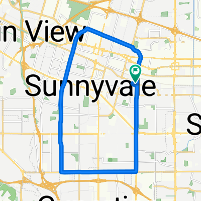
108 S Sunnyvale Ave, Sunnyvale to 801–899 Pyrus Way, Sunnyvale
A cycling route starting in Sunnyvale, California, United States of America.
Overview
About this route
- 10 min
- Duration
- 3 km
- Distance
- 22 m
- Ascent
- 5 m
- Descent
- 17.4 km/h
- Avg. speed
- 47 m
- Avg. speed

Route quality
Waytypes & surfaces along the route
Waytypes
Quiet road
1.7 km
(58 %)
Road
0.9 km
(31 %)
Surfaces
Paved
3 km
(99 %)
Asphalt
2.3 km
(76 %)
Paved (undefined)
0.4 km
(13 %)
Continue with Bikemap
Use, edit, or download this cycling route
You would like to ride 108 S Sunnyvale Ave, Sunnyvale to 801–899 Pyrus Way, Sunnyvale or customize it for your own trip? Here is what you can do with this Bikemap route:
Free features
- Save this route as favorite or in collections
- Copy & plan your own version of this route
- Sync your route with Garmin or Wahoo
Premium features
Free trial for 3 days, or one-time payment. More about Bikemap Premium.
- Navigate this route on iOS & Android
- Export a GPX / KML file of this route
- Create your custom printout (try it for free)
- Download this route for offline navigation
Discover more Premium features.
Get Bikemap PremiumFrom our community
Other popular routes starting in Sunnyvale
 Evelyn & Wolfe, Sunnyvale to South Wolfe Road 175, Sunnyvale
- Distance
- 17.5 km
- Ascent
- 79 m
- Descent
- 79 m
- Location
- Sunnyvale, California, United States of America
 To Rancho San Antonio Open Space Preserve
- Distance
- 9.8 km
- Ascent
- 144 m
- Descent
- 64 m
- Location
- Sunnyvale, California, United States of America
 Sunnyvale/Page Mill loop
- Distance
- 67 km
- Ascent
- 875 m
- Descent
- 877 m
- Location
- Sunnyvale, California, United States of America
 Sunnyvale-Saratoga loop
- Distance
- 41.5 km
- Ascent
- 445 m
- Descent
- 418 m
- Location
- Sunnyvale, California, United States of America
 From San Jose to Sunnyvale
- Distance
- 22.1 km
- Ascent
- 58 m
- Descent
- 56 m
- Location
- Sunnyvale, California, United States of America
 Sunnyvale - Saratoga loop through Big Basin Way
- Distance
- 35.4 km
- Ascent
- 296 m
- Descent
- 293 m
- Location
- Sunnyvale, California, United States of America
 Montebello Rd - Black mountain
- Distance
- 19 km
- Ascent
- 815 m
- Descent
- 83 m
- Location
- Sunnyvale, California, United States of America
 Sunnyvale-Mountain View-Stevens Creek-Stevens Canyon Road
- Distance
- 51.6 km
- Ascent
- 408 m
- Descent
- 406 m
- Location
- Sunnyvale, California, United States of America