Premium Badge Download on the App Store Get it on Google Play Turn-by-turn Navigation Offline Maps Bike Type Optimized Routing Premium Maps Custom Bike Computer Export Routes Route Previews Fall Detection Premium Support

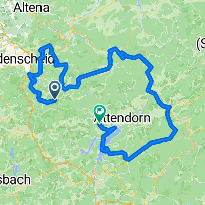
Cycling Route in Herscheid, North Rhine-Westphalia, Germany

"Herscheid - Triathlon" - Radstrecke

0
Open this route in the Bikemap app

Open this route in the Bikemap app

Open this route in Bikemap Web

Open this route in Bikemap Web

12 km
Distance
233 m
Ascent
231 m
Descent
-:-- h
Duration
-- km/h
Avg. Speed
555 m
Max. Elevation

About This Route

Herscheid - Triathlon

  • www.herscheid-triathlon.de
  • Termin 28. Mai 2011
  • Anspruchsvolle ca. 11 km lange Radstrecke !
  • Ca. 217 Höhenmeter pro Runde !
  • Der ca. 2,5 km lange Streckenabschnitt ab Kreuzung Unterdorfstr. / L 707 Valberter Str. bis zur Kreuzung L 696 Lütgenbruch / L 707 wird durch die Feuerwehr Herscheid abgesichert.
  • Der 8,5 km lange weitere Verlauf des Rundkurses (In den Erlen - Neuemühle - Stottmert - Piene - An der Helle - Im Uerp - Unterdorfstr.)   ist für den öffentlichen Verkehr komplett gesperrt !<br />
  • Kinder - Schüler - Jugend - Staffeln - Volkstriathlon <br />
  • www.rcl-98.de
  • Herscheid - Keine Ausreden !<br />

This cycling route is ideal for: Road bike

You will cycle on the following surfaces: Paved

Customize this cycling route with the Bikemap route planner.

Make it yours!

Did you know? You can use this route as a template in our cycling route planner if you don't wish to start from scratch. Customize it based on your needs to plan your perfect cycling tour.

Open it in the app