

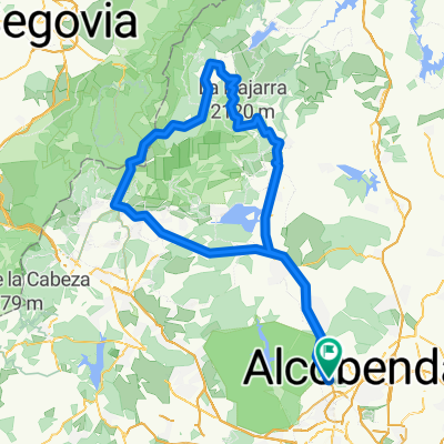
Madrid - Colmenar Viejo.
A cycling route starting in Las Tablas, Madrid, Spain.
Overview
About this route
Carril bici desde el anillo verde-Montecarmelo a Colmenar Viejo.
- -:--
- Duration
- 47.1 km
- Distance
- 304 m
- Ascent
- 304 m
- Descent
- ---
- Avg. speed
- ---
- Avg. speed
Route quality
Waytypes & surfaces along the route
Waytypes
Cycleway
40.2 km
(85 %)
Path
2.9 km
(6 %)
Surfaces
Paved
28.8 km
(61 %)
Unpaved
0.1 km
(<1 %)
Asphalt
25.1 km
(53 %)
Concrete
3.7 km
(8 %)
Continue with Bikemap
Use, edit, or download this cycling route
You would like to ride Madrid - Colmenar Viejo. or customize it for your own trip? Here is what you can do with this Bikemap route:
Free features
- Save this route as favorite or in collections
- Copy & plan your own version of this route
- Sync your route with Garmin or Wahoo
Premium features
Free trial for 3 days, or one-time payment. More about Bikemap Premium.
- Navigate this route on iOS & Android
- Export a GPX / KML file of this route
- Create your custom printout (try it for free)
- Download this route for offline navigation
Discover more Premium features.
Get Bikemap PremiumFrom our community
Other popular routes starting in Las Tablas
 Anillo Ciclista recontando Casa de Campo por Madrid Rio
- Distance
- 54.3 km
- Ascent
- 273 m
- Descent
- 276 m
- Location
- Las Tablas, Madrid, Spain
 Circuito Las Tablas - Sanchinarro
- Distance
- 10.6 km
- Ascent
- 182 m
- Descent
- 180 m
- Location
- Las Tablas, Madrid, Spain
 RUTACHATFÓSILES
- Distance
- 17.3 km
- Ascent
- 913 m
- Descent
- 917 m
- Location
- Las Tablas, Madrid, Spain
 Anillo Verde Ciclista Madrid
- Distance
- 70.1 km
- Ascent
- 387 m
- Descent
- 390 m
- Location
- Las Tablas, Madrid, Spain
 ciudad escolar-castillo de viñuelas
- Distance
- 14.6 km
- Ascent
- 170 m
- Descent
- 218 m
- Location
- Las Tablas, Madrid, Spain
 MADSEG19_TR1
- Distance
- 62.3 km
- Ascent
- 989 m
- Descent
- 510 m
- Location
- Las Tablas, Madrid, Spain
 Navacerrada y Morcuera desde la Academia
- Distance
- 134.4 km
- Ascent
- 1,847 m
- Descent
- 1,846 m
- Location
- Las Tablas, Madrid, Spain
 Ruta Valdelatas Escuela Triatlón HP-Saludando CLONED FROM ROUTE 449510
- Distance
- 19 km
- Ascent
- 237 m
- Descent
- 235 m
- Location
- Las Tablas, Madrid, Spain
Open it in the app