

TL 2025 - 2. Tag - kurz
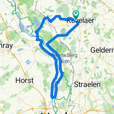
A cycling route starting in Kevelaer, North Rhine-Westphalia, Germany.
Overview
About this route
- 8 h 16 min
- Duration
- 135.2 km
- Distance
- 313 m
- Ascent
- 313 m
- Descent
- 16.4 km/h
- Avg. speed
- 88 m
- Avg. speed
Route quality
Waytypes & surfaces along the route
Waytypes
Road
51 km
(38 %)
Quiet road
20.3 km
(15 %)
Surfaces
Paved
96.7 km
(71 %)
Unpaved
0.1 km
(<1 %)
Asphalt
95.8 km
(71 %)
Paved (undefined)
0.8 km
(<1 %)
Route highlights
Points of interest along the route
Point of interest after 50 km
2. Tag, 1. Pause: Bäckerei Achten im REWE-Markt, Hochstraße 75, 41372 Niederkrüchten
Point of interest after 87.5 km
2. Pause: 2. Tag, 2. Pause: Bäckerei Büsch (EDEKA) Westgraben 5-7 41751 Viersen
Continue with Bikemap
Use, edit, or download this cycling route
You would like to ride TL 2025 - 2. Tag - kurz or customize it for your own trip? Here is what you can do with this Bikemap route:
Free features
- Save this route as favorite or in collections
- Copy & plan your own version of this route
- Sync your route with Garmin or Wahoo
Premium features
Free trial for 3 days, or one-time payment. More about Bikemap Premium.
- Navigate this route on iOS & Android
- Export a GPX / KML file of this route
- Create your custom printout (try it for free)
- Download this route for offline navigation
Discover more Premium features.
Get Bikemap PremiumFrom our community
Other popular routes starting in Kevelaer
 Arcen Faehre
- Distance
- 45.4 km
- Ascent
- 59 m
- Descent
- 57 m
- Location
- Kevelaer, North Rhine-Westphalia, Germany
 Niers Wemb - Weeze 100km
- Distance
- 51.9 km
- Ascent
- 70 m
- Descent
- 87 m
- Location
- Kevelaer, North Rhine-Westphalia, Germany
 Schauen wir mal :-)
- Distance
- 157.7 km
- Ascent
- 99 m
- Descent
- 99 m
- Location
- Kevelaer, North Rhine-Westphalia, Germany
 TL 2025 - 3. Tag - kurz
- Distance
- 125.1 km
- Ascent
- 213 m
- Descent
- 214 m
- Location
- Kevelaer, North Rhine-Westphalia, Germany
 TL 2025 - 2. Tag - lang
- Distance
- 168.4 km
- Ascent
- 1,128 m
- Descent
- 1,124 m
- Location
- Kevelaer, North Rhine-Westphalia, Germany
 Ausfahrt über Wenn
- Distance
- 20.4 km
- Ascent
- 29 m
- Descent
- 30 m
- Location
- Kevelaer, North Rhine-Westphalia, Germany
 Photo Safari mit Mölle
- Distance
- 150.8 km
- Ascent
- 83 m
- Descent
- 86 m
- Location
- Kevelaer, North Rhine-Westphalia, Germany
 An der Maas entlang
- Distance
- 59.7 km
- Ascent
- 61 m
- Descent
- 60 m
- Location
- Kevelaer, North Rhine-Westphalia, Germany