

Col de la Givrine zum Marchairuz
A cycling route starting in Saint-Cergue, Canton of Vaud, Switzerland.
Overview
About this route
Wunderschöne Strecke, ca. 2km über Felder (fahrbar mit City-Bike).
- -:--
- Duration
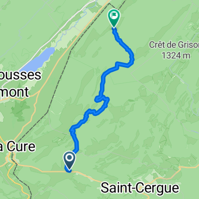
- 18.5 km
- Distance
- 364 m
- Ascent
- 233 m
- Descent
- ---
- Avg. speed
- ---
- Avg. speed
Continue with Bikemap
Use, edit, or download this cycling route
You would like to ride Col de la Givrine zum Marchairuz or customize it for your own trip? Here is what you can do with this Bikemap route:
Free features
- Save this route as favorite or in collections
- Copy & plan your own version of this route
- Sync your route with Garmin or Wahoo
Premium features
Free trial for 3 days, or one-time payment. More about Bikemap Premium.
- Navigate this route on iOS & Android
- Export a GPX / KML file of this route
- Create your custom printout (try it for free)
- Download this route for offline navigation
Discover more Premium features.
Get Bikemap PremiumFrom our community
Other popular routes starting in Saint-Cergue
 France Ultime : Belfort - Les Rousses
- Distance
- 214.3 km
- Ascent
- 1,500 m
- Descent
- 2,208 m
- Location
- Saint-Cergue, Canton of Vaud, Switzerland
 Jura2011(B): Col de la Givrine bis Goumois
- Distance
- 191.2 km
- Ascent
- 1,351 m
- Descent
- 2,062 m
- Location
- Saint-Cergue, Canton of Vaud, Switzerland
 2020 - Gorets - J3 - P1
- Distance
- 11.9 km
- Ascent
- 459 m
- Descent
- 366 m
- Location
- Saint-Cergue, Canton of Vaud, Switzerland
 St Cergue - Grutli - Les Fruitieres de Nyon
- Distance
- 24.8 km
- Ascent
- 653 m
- Descent
- 610 m
- Location
- Saint-Cergue, Canton of Vaud, Switzerland
 JuraTotal
- Distance
- 243 km
- Ascent
- 1,967 m
- Descent
- 2,465 m
- Location
- Saint-Cergue, Canton of Vaud, Switzerland
 Untitled route
- Distance
- 62.9 km
- Ascent
- 1,360 m
- Descent
- 1,871 m
- Location
- Saint-Cergue, Canton of Vaud, Switzerland
 sommet baudichone - givrine
- Distance
- 8.1 km
- Ascent
- 187 m
- Descent
- 378 m
- Location
- Saint-Cergue, Canton of Vaud, Switzerland
 retour st cergues le Muids Nyon
- Distance
- 19.9 km
- Ascent
- 50 m
- Descent
- 707 m
- Location
- Saint-Cergue, Canton of Vaud, Switzerland
Open it in the app