

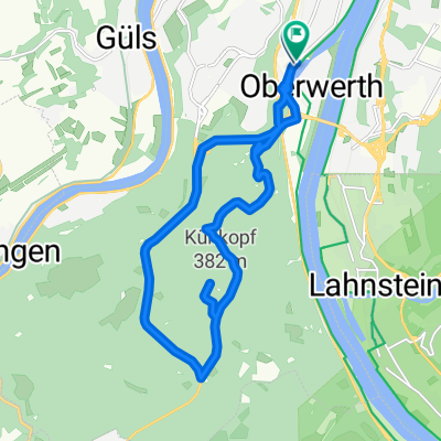
2025 6 Koblenz Wiesbaden
A cycling route starting in Koblenz, Rhineland-Palatinate, Germany.
Overview
About this route
- 5 h 43 min
- Duration
- 91 km
- Distance
- 814 m
- Ascent
- 803 m
- Descent
- 15.9 km/h
- Avg. speed
- 128 m
- Avg. speed
Route quality
Waytypes & surfaces along the route
Waytypes
Path
43 km
(47 %)
Track
18.6 km
(20 %)
Surfaces
Paved
84.2 km
(92 %)
Unpaved
3.2 km
(4 %)
Asphalt
69.6 km
(76 %)
Paving stones
11.3 km
(12 %)
Continue with Bikemap
Use, edit, or download this cycling route
You would like to ride 2025 6 Koblenz Wiesbaden or customize it for your own trip? Here is what you can do with this Bikemap route:
Free features
- Save this route as favorite or in collections
- Copy & plan your own version of this route
- Sync your route with Garmin or Wahoo
Premium features
Free trial for 3 days, or one-time payment. More about Bikemap Premium.
- Navigate this route on iOS & Android
- Export a GPX / KML file of this route
- Create your custom printout (try it for free)
- Download this route for offline navigation
Discover more Premium features.
Get Bikemap PremiumFrom our community
Other popular routes starting in Koblenz
 moseltour trier - koblenz
- Distance
- 205.6 km
- Ascent
- 554 m
- Descent
- 483 m
- Location
- Koblenz, Rhineland-Palatinate, Germany
 Mosel Thionville Mosel
- Distance
- 267 km
- Ascent
- 1,060 m
- Descent
- 989 m
- Location
- Koblenz, Rhineland-Palatinate, Germany
 KO-Fleckertshöhe-Alken-KO
- Distance
- 77.8 km
- Ascent
- 569 m
- Descent
- 568 m
- Location
- Koblenz, Rhineland-Palatinate, Germany
 Winter
- Distance
- 15.5 km
- Ascent
- 360 m
- Descent
- 360 m
- Location
- Koblenz, Rhineland-Palatinate, Germany
 Koblenz - Bad Ems
- Distance
- 16.1 km
- Ascent
- 148 m
- Descent
- 139 m
- Location
- Koblenz, Rhineland-Palatinate, Germany
 Koblenz-Trier
- Distance
- 199.6 km
- Ascent
- 1,926 m
- Descent
- 1,863 m
- Location
- Koblenz, Rhineland-Palatinate, Germany
 Eisenarsch-Tour 2009 (Vorschlag)
- Distance
- 174.5 km
- Ascent
- 424 m
- Descent
- 353 m
- Location
- Koblenz, Rhineland-Palatinate, Germany
 CYCLING THE RHINE: Route 12A
- Distance
- 49.7 km
- Ascent
- 179 m
- Descent
- 152 m
- Location
- Koblenz, Rhineland-Palatinate, Germany