

RUNDA Cerklje ALPE CULT (3040 mnv)
A cycling route starting in Cerklje na Gorenjskem, Municipality of Cerklje na Gorenjskem, Slovenia.
Overview
About this route
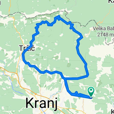
cerklje blok - grad - štefanja gora - makadam 1km - možjanca - tupaliče - zgornje jezersko - pavličevo sedlo - logarska dolina - luče - podvolovljek - kamnik tunjiška cesta - sidraž - šentrurška gora - grad - blok cerklje
- -:--
- Duration
- 116.8 km
- Distance
- 2,310 m
- Ascent
- 2,310 m
- Descent
- ---
- Avg. speed
- ---
- Avg. speed
Route quality
Waytypes & surfaces along the route
Waytypes
Busy road
66.6 km
(57 %)
Road
28.1 km
(24 %)
Surfaces
Paved
79.7 km
(68 %)
Unpaved
1.3 km
(1 %)
Asphalt
79.7 km
(68 %)
Gravel
1 km
(<1 %)
Continue with Bikemap
Use, edit, or download this cycling route
You would like to ride RUNDA Cerklje ALPE CULT (3040 mnv) or customize it for your own trip? Here is what you can do with this Bikemap route:
Free features
- Save this route as favorite or in collections
- Copy & plan your own version of this route
- Sync your route with Garmin or Wahoo
Premium features
Free trial for 3 days, or one-time payment. More about Bikemap Premium.
- Navigate this route on iOS & Android
- Export a GPX / KML file of this route
- Create your custom printout (try it for free)
- Download this route for offline navigation
Discover more Premium features.
Get Bikemap PremiumFrom our community
Other popular routes starting in Cerklje na Gorenjskem
 Nova tura
- Distance
- 36.1 km
- Ascent
- 257 m
- Descent
- 258 m
- Location
- Cerklje na Gorenjskem, Municipality of Cerklje na Gorenjskem, Slovenia
 Trzic Jelendol Jezersko
- Distance
- 84.7 km
- Ascent
- 1,760 m
- Descent
- 1,760 m
- Location
- Cerklje na Gorenjskem, Municipality of Cerklje na Gorenjskem, Slovenia
 Cerkljansko & Kamniško
- Distance
- 45.6 km
- Ascent
- 1,159 m
- Descent
- 1,161 m
- Location
- Cerklje na Gorenjskem, Municipality of Cerklje na Gorenjskem, Slovenia
 Krvavec - dol
- Distance
- 14.9 km
- Ascent
- 119 m
- Descent
- 1,189 m
- Location
- Cerklje na Gorenjskem, Municipality of Cerklje na Gorenjskem, Slovenia
 Relaxed route
- Distance
- 37.6 km
- Ascent
- 302 m
- Descent
- 185 m
- Location
- Cerklje na Gorenjskem, Municipality of Cerklje na Gorenjskem, Slovenia
 KRVAVEC (ZVOH 1972m)
- Distance
- 17.3 km
- Ascent
- 1,540 m
- Descent
- 25 m
- Location
- Cerklje na Gorenjskem, Municipality of Cerklje na Gorenjskem, Slovenia
 Grad - Krvavec - Grad
- Distance
- 21.9 km
- Ascent
- 1,261 m
- Descent
- 1,261 m
- Location
- Cerklje na Gorenjskem, Municipality of Cerklje na Gorenjskem, Slovenia
 Okolo Grintovca:)
- Distance
- 134.8 km
- Ascent
- 1,890 m
- Descent
- 1,890 m
- Location
- Cerklje na Gorenjskem, Municipality of Cerklje na Gorenjskem, Slovenia
Open it in the app