Premium Badge Download on the App Store Get it on Google Play Turn-by-turn Navigation Offline Maps Bike Type Optimized Routing Premium Maps Custom Bike Computer Export Routes Route Previews Fall Detection Premium Support

Cycling Route in Ehingen, Baden-Württemberg, Germany

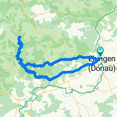
3.1 Ehingen – Blaubeuren besides the main tracks

1
Open this route in the Bikemap app

Open this route in the Bikemap app

Open this route in Bikemap Web

Open this route in Bikemap Web

49 km
Distance
388 m
Ascent
385 m
Descent
-:-- h
Duration
-- km/h
Avg. Speed
--- m
Max. Elevation

About This Route

<span style="font-size: x-small;"><font color="#000000"><font face="Arial"><span style="mso-ansi-language: EN-GB;" lang="EN-GB">Start from the city center (Market place) down to the railroad station and keep following the street in the left direction (Pfisterstraße) you soon will notice the bicycle trail marking which you will follow in the direction to Berkach. Until the town of </span><span style="mso-ansi-language: EN-GB;" lang="EN-GB">Allmendingen</span><span style="mso-ansi-language: EN-GB;" lang="EN-GB"> you will follow the marked trail. In Allmendingen you cross the main street and steer in the direction of the stone quarry when you are suddenly in the nature far from any traffic. Enjoy the ride through the fields and valleys when after 10 km you will have a beautiful sight from up down to Blaubeuren. Drive through the town to the famous “Blautopf”, a well with a little lake with a wonderful green water. Drive back to Ehingen in the wide valley following the marked bicycle paths.</span></font></font></span>

This cycling route is ideal for: MTB

You will cycle on the following surfaces: Paved Unpaved Gravel

Customize this cycling route with the Bikemap route planner.

Make it yours!

Did you know? You can use this route as a template in our cycling route planner if you don't wish to start from scratch. Customize it based on your needs to plan your perfect cycling tour.

Open it in the app