
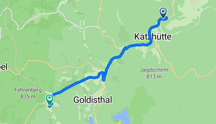
2025-05-07_Katzhütte-Hotel Masserberg
A cycling route starting in Katzhütte, Free State of Thuringia, Germany.
Overview
About this route
- 54 min
- Duration
- 11.7 km
- Distance
- 492 m
- Ascent
- 127 m
- Descent
- 13 km/h
- Avg. speed
- 796 m
- Avg. speed

Route quality
Waytypes & surfaces along the route
Waytypes
Quiet road
3.4 km
(29 %)
Access road
2.7 km
(23 %)
Surfaces
Paved
8.1 km
(69 %)
Unpaved
2.3 km
(19 %)
Asphalt
8.1 km
(69 %)
Ground
1.6 km
(13 %)
Continue with Bikemap
Use, edit, or download this cycling route
You would like to ride 2025-05-07_Katzhütte-Hotel Masserberg or customize it for your own trip? Here is what you can do with this Bikemap route:
Free features
- Save this route as favorite or in collections
- Copy & plan your own version of this route
- Sync your route with Garmin or Wahoo
Premium features
Free trial for 3 days, or one-time payment. More about Bikemap Premium.
- Navigate this route on iOS & Android
- Export a GPX / KML file of this route
- Create your custom printout (try it for free)
- Download this route for offline navigation
Discover more Premium features.
Get Bikemap PremiumFrom our community
Other popular routes starting in Katzhütte
 2025-05-07_Katzhütte-Hotel Masserberg
- Distance
- 11.7 km
- Ascent
- 492 m
- Descent
- 127 m
- Location
- Katzhütte, Free State of Thuringia, Germany
 Katzhuette Ebenhards
- Distance
- 46.7 km
- Ascent
- 525 m
- Descent
- 593 m
- Location
- Katzhütte, Free State of Thuringia, Germany
 Katzhuette Sachsenbrunn
- Distance
- 20 km
- Ascent
- 424 m
- Descent
- 349 m
- Location
- Katzhütte, Free State of Thuringia, Germany
 Katzhütte-Ilmenau-NeustadtRstg-Masserberg-Katzhütte
- Distance
- 71.4 km
- Ascent
- 1,169 m
- Descent
- 1,029 m
- Location
- Katzhütte, Free State of Thuringia, Germany
 Katzhütte-Leutnitz 1
- Distance
- 34.3 km
- Ascent
- 268 m
- Descent
- 438 m
- Location
- Katzhütte, Free State of Thuringia, Germany
 Radtour Katzhütte - geplant
- Distance
- 42.6 km
- Ascent
- 550 m
- Descent
- 557 m
- Location
- Katzhütte, Free State of Thuringia, Germany
 Thüringen Tag 2.1
- Distance
- 11.4 km
- Ascent
- 466 m
- Descent
- 128 m
- Location
- Katzhütte, Free State of Thuringia, Germany
 Katzhütte,NeustadtRtsg, Ilmenau, Gehren, Katzhütte
- Distance
- 58.1 km
- Ascent
- 717 m
- Descent
- 717 m
- Location
- Katzhütte, Free State of Thuringia, Germany
Open it in the app