

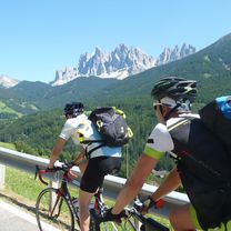
Alpy 2012
A cycling route starting in Kiens, Trentino-Alto Adige, Italy.
Overview
About this route
Alpy 2012 - przejechane z Ciapkiem w dniach 15.06-23.06. W całości asfaltowa, jedynie kilkaset metrów drogą żwirowaną. Bardzo dużo, bardzo ciężkich podjazdów. Prowadzi przez Stelvio oraz Hochtor
- -:--
- Duration
- 785.9 km
- Distance
- 9,131 m
- Ascent
- 9,131 m
- Descent
- ---
- Avg. speed
- ---
- Avg. speed
Continue with Bikemap
Use, edit, or download this cycling route
You would like to ride Alpy 2012 or customize it for your own trip? Here is what you can do with this Bikemap route:
Free features
- Save this route as favorite or in collections
- Copy & plan your own version of this route
- Sync your route with Garmin or Wahoo
Premium features
Free trial for 3 days, or one-time payment. More about Bikemap Premium.
- Navigate this route on iOS & Android
- Export a GPX / KML file of this route
- Create your custom printout (try it for free)
- Download this route for offline navigation
Discover more Premium features.
Get Bikemap PremiumFrom our community
Other popular routes starting in Kiens
 Ausfahrt durch Kiens
- Distance
- 17.6 km
- Ascent
- 426 m
- Descent
- 428 m
- Location
- Kiens, Trentino-Alto Adige, Italy
 Ausfahrt durch Kiens
- Distance
- 14.5 km
- Ascent
- 438 m
- Descent
- 440 m
- Location
- Kiens, Trentino-Alto Adige, Italy
 Würzjoch 2015_1
- Distance
- 111.4 km
- Ascent
- 1,972 m
- Descent
- 1,396 m
- Location
- Kiens, Trentino-Alto Adige, Italy
 Venedig 2014 Tag 9
- Distance
- 98.3 km
- Ascent
- 1,146 m
- Descent
- 1,071 m
- Location
- Kiens, Trentino-Alto Adige, Italy
 Türbotour_44
- Distance
- 53.4 km
- Ascent
- 207 m
- Descent
- 461 m
- Location
- Kiens, Trentino-Alto Adige, Italy
 Ausfahrt durch Kiens
- Distance
- 15.5 km
- Ascent
- 398 m
- Descent
- 400 m
- Location
- Kiens, Trentino-Alto Adige, Italy
 Kiens-St.Vigilio a zpět
- Distance
- 37.1 km
- Ascent
- 726 m
- Descent
- 725 m
- Location
- Kiens, Trentino-Alto Adige, Italy
 Im Moos 12, Kiens nach Im Moos 11, Kiens
- Distance
- 11 km
- Ascent
- 723 m
- Descent
- 723 m
- Location
- Kiens, Trentino-Alto Adige, Italy
Open it in the app