

Bestenheid-Tauberbischofsheim-Bestenheid
A cycling route starting in Hasloch, Bavaria, Germany.
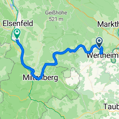
Overview
About this route
- 4 h 23 min
- Duration
- 71.2 km
- Distance
- 1,448 m
- Ascent
- 1,466 m
- Descent
- 16.3 km/h
- Avg. speed
- 437 m
- Avg. speed

Route quality
Waytypes & surfaces along the route
Waytypes
Track
31.7 km
(45 %)
Quiet road
24.4 km
(34 %)
Surfaces
Paved
67.9 km
(95 %)
Unpaved
0 km
(<1 %)
Asphalt
46.4 km
(65 %)
Paved (undefined)
21.5 km
(30 %)
Continue with Bikemap
Use, edit, or download this cycling route
You would like to ride Bestenheid-Tauberbischofsheim-Bestenheid or customize it for your own trip? Here is what you can do with this Bikemap route:
Free features
- Save this route as favorite or in collections
- Copy & plan your own version of this route
- Sync your route with Garmin or Wahoo
Premium features
Free trial for 3 days, or one-time payment. More about Bikemap Premium.
- Navigate this route on iOS & Android
- Export a GPX / KML file of this route
- Create your custom printout (try it for free)
- Download this route for offline navigation
Discover more Premium features.
Get Bikemap PremiumFrom our community
Other popular routes starting in Hasloch
 Hasloch bis Bettingen
- Distance
- 14.9 km
- Ascent
- 204 m
- Descent
- 208 m
- Location
- Hasloch, Bavaria, Germany
 Nürnberg - Koblenz Etappe 8/13
- Distance
- 48.3 km
- Ascent
- 172 m
- Descent
- 194 m
- Location
- Hasloch, Bavaria, Germany
 von zu Hause zur Nickelsmühle
- Distance
- 7.2 km
- Ascent
- 211 m
- Descent
- 164 m
- Location
- Hasloch, Bavaria, Germany
 Bestenheid-Lohr a.M.-Bestenheid
- Distance
- 96 km
- Ascent
- 1,016 m
- Descent
- 1,016 m
- Location
- Hasloch, Bavaria, Germany
 Vom Main zur Tauber
- Distance
- 34.4 km
- Ascent
- 831 m
- Descent
- 786 m
- Location
- Hasloch, Bavaria, Germany
 Etappe_09_bike
- Distance
- 53.7 km
- Ascent
- 183 m
- Descent
- 203 m
- Location
- Hasloch, Bavaria, Germany
 Bestenheid-Tauberbischofsheim-Bestenheid
- Distance
- 71.2 km
- Ascent
- 1,448 m
- Descent
- 1,466 m
- Location
- Hasloch, Bavaria, Germany
 Main und Tauber
- Distance
- 33.3 km
- Ascent
- 371 m
- Descent
- 333 m
- Location
- Hasloch, Bavaria, Germany