

Napsugár utca, Csomád - Napsugár utca, Csomád
A cycling route starting in Őrbottyán, Pest County, Hungary.
Overview
About this route
- 1 h 37 min
- Duration
- 30.4 km
- Distance
- 254 m
- Ascent
- 254 m
- Descent
- 18.8 km/h
- Avg. speed
- 257 m
- Max. altitude

Route quality
Waytypes & surfaces along the route
Waytypes
Road
7 km
(23 %)
Quiet road
4.9 km
(16 %)
Surfaces
Paved
22.2 km
(73 %)
Unpaved
1.2 km
(4 %)
Asphalt
22.2 km
(73 %)
Gravel
1.2 km
(4 %)
Undefined
7 km
(23 %)
Continue with Bikemap
Use, edit, or download this cycling route
You would like to ride Napsugár utca, Csomád - Napsugár utca, Csomád or customize it for your own trip? Here is what you can do with this Bikemap route:
Free features
- Save this route as favorite or in collections
- Copy & plan your own version of this route
- Sync your route with Garmin or Wahoo
Premium features
Free trial for 3 days, or one-time payment. More about Bikemap Premium.
- Navigate this route on iOS & Android
- Export a GPX / KML file of this route
- Create your custom printout (try it for free)
- Download this route for offline navigation
Discover more Premium features.
Get Bikemap PremiumFrom our community
Other popular routes starting in Őrbottyán
 Erkel Ferenc utca, Veresegyház - Evezős utca, Göd
- Distance
- 17.5 km
- Ascent
- 97 m
- Descent
- 167 m
- Location
- Őrbottyán, Pest County, Hungary
 Veres kertes örbottyan veres
- Distance
- 18.8 km
- Ascent
- 124 m
- Descent
- 122 m
- Location
- Őrbottyán, Pest County, Hungary
 Őrbottyàn - Budapest "rövidített"
- Distance
- 39.7 km
- Ascent
- 687 m
- Descent
- 773 m
- Location
- Őrbottyán, Pest County, Hungary
 Napsugár utca, Csomád - Napsugár utca, Csomád
- Distance
- 30.4 km
- Ascent
- 254 m
- Descent
- 254 m
- Location
- Őrbottyán, Pest County, Hungary
 Vácrátót-Letkés
- Distance
- 132.2 km
- Ascent
- 294 m
- Descent
- 294 m
- Location
- Őrbottyán, Pest County, Hungary
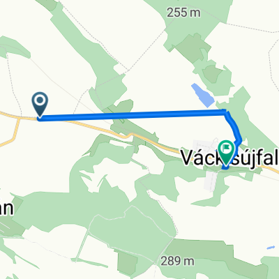 2105, Őrbottyán - Petőfi Sándor utca 53, Váckisújfalu
- Distance
- 3.9 km
- Ascent
- 12 m
- Descent
- 50 m
- Location
- Őrbottyán, Pest County, Hungary
 75678657
- Distance
- 181.8 km
- Ascent
- 608 m
- Descent
- 692 m
- Location
- Őrbottyán, Pest County, Hungary
 Őrbottyán - Aszód - Bag - Gödöllő
- Distance
- 69.7 km
- Ascent
- 456 m
- Descent
- 446 m
- Location
- Őrbottyán, Pest County, Hungary
Open it in the app