

2012/11 Kuryłówka - Szegdy - Dobra - Piskorowice
A cycling route starting in Kuryłówka, Subcarpathian Voivodeship, Poland.
Overview
About this route
Trasa przejechana 30 czerwca 2012 r.
- -:--
- Duration
- 67.9 km
- Distance
- 201 m
- Ascent
- 201 m
- Descent
- ---
- Avg. speed
- ---
- Avg. speed
Route quality
Waytypes & surfaces along the route
Waytypes
Road
36.8 km
(54 %)
Quiet road
23.3 km
(34 %)
Surfaces
Paved
51.4 km
(76 %)
Asphalt
51.4 km
(76 %)
Undefined
16.5 km
(24 %)
Route highlights
Points of interest along the route
Point of interest after 46.5 km
Continue with Bikemap
Use, edit, or download this cycling route
You would like to ride 2012/11 Kuryłówka - Szegdy - Dobra - Piskorowice or customize it for your own trip? Here is what you can do with this Bikemap route:
Free features
- Save this route as favorite or in collections
- Copy & plan your own version of this route
- Sync your route with Garmin or Wahoo
Premium features
Free trial for 3 days, or one-time payment. More about Bikemap Premium.
- Navigate this route on iOS & Android
- Export a GPX / KML file of this route
- Create your custom printout (try it for free)
- Download this route for offline navigation
Discover more Premium features.
Get Bikemap PremiumFrom our community
Other popular routes starting in Kuryłówka
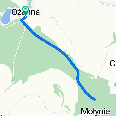
 Ożanna do Wylewa
- Distance
- 17.7 km
- Ascent
- 67 m
- Descent
- 85 m
- Location
- Kuryłówka, Subcarpathian Voivodeship, Poland
 Szlam
Szlam- Distance
- 186 km
- Ascent
- 651 m
- Descent
- 649 m
- Location
- Kuryłówka, Subcarpathian Voivodeship, Poland
 Polska 2014 Dzień 2
- Distance
- 66.2 km
- Ascent
- 208 m
- Descent
- 105 m
- Location
- Kuryłówka, Subcarpathian Voivodeship, Poland
 2012/11 Kuryłówka - Szegdy - Dobra - Piskorowice
- Distance
- 67.9 km
- Ascent
- 201 m
- Descent
- 201 m
- Location
- Kuryłówka, Subcarpathian Voivodeship, Poland
 Spokojna jazda
- Distance
- 53.6 km
- Ascent
- 447 m
- Descent
- 448 m
- Location
- Kuryłówka, Subcarpathian Voivodeship, Poland
 RajdWokółGminyLeżajsk
- Distance
- 90.4 km
- Ascent
- 335 m
- Descent
- 334 m
- Location
- Kuryłówka, Subcarpathian Voivodeship, Poland
 Ożanna do Ożanna
- Distance
- 15.7 km
- Ascent
- 53 m
- Descent
- 84 m
- Location
- Kuryłówka, Subcarpathian Voivodeship, Poland
 54A do Ożanna
- Distance
- 9.1 km
- Ascent
- 37 m
- Descent
- 34 m
- Location
- Kuryłówka, Subcarpathian Voivodeship, Poland
Open it in the app