
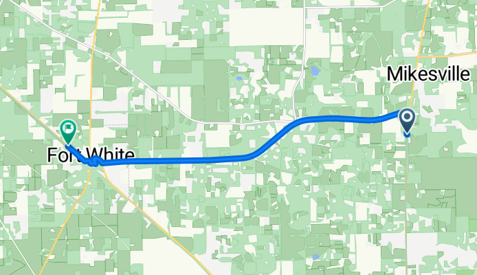
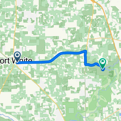
SE Sprite Loop, Aguasaltas a US-27, Fort White
A cycling route starting in High Springs, Florida, United States of America.
Overview
About this route
- 1 h 2 min
- Duration
- 12.9 km
- Distance
- 53 m
- Ascent
- 55 m
- Descent
- 12.4 km/h
- Avg. speed
- 40 m
- Avg. speed

Route photos


Route quality
Waytypes & surfaces along the route
Waytypes
Cycleway
9.6 km
(75 %)
Busy road
1.1 km
(8 %)
Surfaces
Paved
10.7 km
(83 %)
Paved (undefined)
9.6 km
(75 %)
Asphalt
1.1 km
(8 %)
Undefined
2.2 km
(17 %)
Continue with Bikemap
Use, edit, or download this cycling route
You would like to ride SE Sprite Loop, Aguasaltas a US-27, Fort White or customize it for your own trip? Here is what you can do with this Bikemap route:
Free features
- Save this route as favorite or in collections
- Copy & plan your own version of this route
- Sync your route with Garmin or Wahoo
Premium features
Free trial for 3 days, or one-time payment. More about Bikemap Premium.
- Navigate this route on iOS & Android
- Export a GPX / KML file of this route
- Create your custom printout (try it for free)
- Download this route for offline navigation
Discover more Premium features.
Get Bikemap PremiumFrom our community
Other popular routes starting in High Springs
 O'Leno State Park Trail, High Springs to O'Leno State Park Trail, High Springs
- Distance
- 2.8 km
- Ascent
- 17 m
- Descent
- 16 m
- Location
- High Springs, Florida, United States of America
- SE Sprite Loop, Aguasaltas a US-27, Fort White
- Distance
- 12.9 km
- Ascent
- 53 m
- Descent
- 55 m
- Location
- High Springs, Florida, United States of America
 20220108 Oleno State Park
- Distance
- 82.6 km
- Ascent
- 1,574 m
- Descent
- 1,574 m
- Location
- High Springs, Florida, United States of America
 SW County Road 18, Fort White a SE Oleno Park Rd, Aguasaltas
- Distance
- 15.2 km
- Ascent
- 74 m
- Descent
- 72 m
- Location
- High Springs, Florida, United States of America
 130 Cochran Cir, Fort White to 7776 US-27, Fort White
- Distance
- 59 km
- Ascent
- 373 m
- Descent
- 369 m
- Location
- High Springs, Florida, United States of America
 1771–1899 SW Central Terr, Fort White to 200–298 S Mulberry St, Monticello
- Distance
- 150.3 km
- Ascent
- 1,342 m
- Descent
- 1,275 m
- Location
- High Springs, Florida, United States of America
 Moonshine Acres to Itchetucknee SP
- Distance
- 20.7 km
- Ascent
- 72 m
- Descent
- 69 m
- Location
- High Springs, Florida, United States of America
 SEALs Bike America Day #33
- Distance
- 107 km
- Ascent
- 140 m
- Descent
- 150 m
- Location
- High Springs, Florida, United States of America
Open it in the app