

Grießbühl-Kienzerle, Tannheim nach Kirchplatz, Weißenbach am Lech
A cycling route starting in Zöblen, Tyrol, Austria.
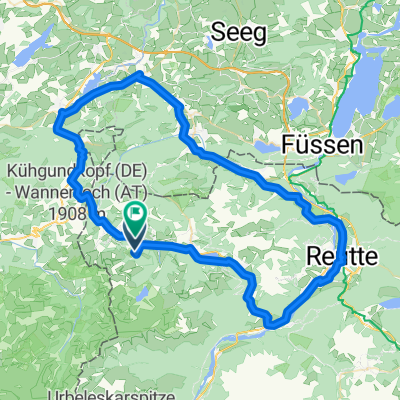
Overview
About this route
- 1 h 23 min
- Duration
- 19.2 km
- Distance
- 278 m
- Ascent
- 498 m
- Descent
- 13.9 km/h
- Avg. speed
- 1,166 m
- Avg. speed
Route photos

Route quality
Waytypes & surfaces along the route
Waytypes
Track
8.2 km
(43 %)
Quiet road
4.6 km
(24 %)
Surfaces
Paved
10.9 km
(57 %)
Unpaved
4.8 km
(25 %)
Asphalt
9.1 km
(48 %)
Gravel
3 km
(16 %)
Continue with Bikemap
Use, edit, or download this cycling route
You would like to ride Grießbühl-Kienzerle, Tannheim nach Kirchplatz, Weißenbach am Lech or customize it for your own trip? Here is what you can do with this Bikemap route:
Free features
- Save this route as favorite or in collections
- Copy & plan your own version of this route
- Sync your route with Garmin or Wahoo
Premium features
Free trial for 3 days, or one-time payment. More about Bikemap Premium.
- Navigate this route on iOS & Android
- Export a GPX / KML file of this route
- Create your custom printout (try it for free)
- Download this route for offline navigation
Discover more Premium features.
Get Bikemap PremiumFrom our community
Other popular routes starting in Zöblen
 Zöblen-Oberjoch-Krummenbach-Schattwald-Zöblen
- Distance
- 17.7 km
- Ascent
- 277 m
- Descent
- 285 m
- Location
- Zöblen, Tyrol, Austria
 Tannheim Wertach UnterjochTannheim
- Distance
- 79.4 km
- Ascent
- 411 m
- Descent
- 574 m
- Location
- Zöblen, Tyrol, Austria
 Durch das Achtal
- Distance
- 35.4 km
- Ascent
- 350 m
- Descent
- 347 m
- Location
- Zöblen, Tyrol, Austria
 Zöblen-Schattwald-Jungholz-Schattwald-Zöblen
- Distance
- 24.8 km
- Ascent
- 409 m
- Descent
- 411 m
- Location
- Zöblen, Tyrol, Austria
 Zöblen 42a, Zöblen nach Dorfstraße 33, Grän
- Distance
- 8.1 km
- Ascent
- 125 m
- Descent
- 283 m
- Location
- Zöblen, Tyrol, Austria
 Tann-Tal-34km-400hm
- Distance
- 34 km
- Ascent
- 533 m
- Descent
- 546 m
- Location
- Zöblen, Tyrol, Austria
 Tannheim
- Distance
- 37 km
- Ascent
- 934 m
- Descent
- 857 m
- Location
- Zöblen, Tyrol, Austria
 Tannheimertal - Allgäurunde - Oberjochpass
- Distance
- 93.3 km
- Ascent
- 689 m
- Descent
- 690 m
- Location
- Zöblen, Tyrol, Austria
Open it in the app