

Münchenbernsdorf - Via Claudia Augusta
A cycling route starting in Münchenbernsdorf, Free State of Thuringia, Germany.
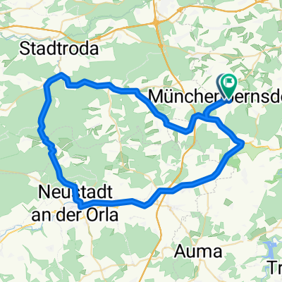
Overview
About this route
Verbindung zur alten Römerstraße nach Venedig oder Ostiglia. Die Strecke ist bis Mönchberg gut auf dem Saaleradweg befahrbar, den ich in der Karte allerdings nicht verfolgt habe!<br />Bis auf den Saaleradweg ist die Strecke relativ dicht befahren, dafür aber eine direkte Verbindung nach Donauwörth.
- -:--
- Duration
- 369 km
- Distance
- 1,383 m
- Ascent
- 1,297 m
- Descent
- ---
- Avg. speed
- ---
- Avg. speed
Route quality
Waytypes & surfaces along the route
Waytypes
Busy road
173.4 km
(47 %)
Road
55 km
(15 %)
Surfaces
Paved
245.5 km
(67 %)
Unpaved
13.9 km
(4 %)
Asphalt
234.3 km
(63 %)
Gravel
8 km
(2 %)
Route highlights
Points of interest along the route
Point of interest after 108.1 km
Continue with Bikemap
Use, edit, or download this cycling route
You would like to ride Münchenbernsdorf - Via Claudia Augusta or customize it for your own trip? Here is what you can do with this Bikemap route:
Free features
- Save this route as favorite or in collections
- Copy & plan your own version of this route
- Sync your route with Garmin or Wahoo
Premium features
Free trial for 3 days, or one-time payment. More about Bikemap Premium.
- Navigate this route on iOS & Android
- Export a GPX / KML file of this route
- Create your custom printout (try it for free)
- Download this route for offline navigation
Discover more Premium features.
Get Bikemap PremiumFrom our community
Other popular routes starting in Münchenbernsdorf
 JMR Münchenbernsdorf
- Distance
- 4.7 km
- Ascent
- 52 m
- Descent
- 52 m
- Location
- Münchenbernsdorf, Free State of Thuringia, Germany
 Winterstrecke (kurz)
- Distance
- 57.6 km
- Ascent
- 455 m
- Descent
- 435 m
- Location
- Münchenbernsdorf, Free State of Thuringia, Germany
 Münchenbernsdorf - Via Claudia Augusta
- Distance
- 369 km
- Ascent
- 1,383 m
- Descent
- 1,297 m
- Location
- Münchenbernsdorf, Free State of Thuringia, Germany
 JMR Münchenbernsdorf
- Distance
- 4.7 km
- Ascent
- 52 m
- Descent
- 52 m
- Location
- Münchenbernsdorf, Free State of Thuringia, Germany
 Training 4
- Distance
- 100 km
- Ascent
- 622 m
- Descent
- 612 m
- Location
- Münchenbernsdorf, Free State of Thuringia, Germany
 Training(Neustadt-Stadtroda-Klosterlausnitz-Kraftsdorf-St. Gangloff-Münchenbernsdorf)
- Distance
- 119 km
- Ascent
- 824 m
- Descent
- 823 m
- Location
- Münchenbernsdorf, Free State of Thuringia, Germany
 Münchenbernsdorf- Remptendorf
- Distance
- 56.3 km
- Ascent
- 532 m
- Descent
- 399 m
- Location
- Münchenbernsdorf, Free State of Thuringia, Germany
 Pfingstrunde
- Distance
- 38.2 km
- Ascent
- 255 m
- Descent
- 256 m
- Location
- Münchenbernsdorf, Free State of Thuringia, Germany
Open it in the app