

Rechberg-Semriach
A cycling route starting in Graz, Styria, Austria.
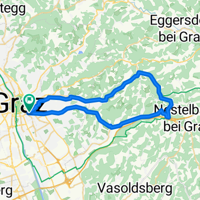
Overview
About this route
Rechberg hat das Wort "Berg" echt verdient: bergstrasse mit idealer Steigung, schönes strasserl nach Semriach
- -:--
- Duration
- 73.4 km
- Distance
- 1,004 m
- Ascent
- 1,014 m
- Descent
- ---
- Avg. speed
- 974 m
- Avg. speed
Route quality
Waytypes & surfaces along the route
Waytypes
Busy road
32.7 km
(45 %)
Cycleway
15.1 km
(21 %)
Surfaces
Paved
71.4 km
(97 %)
Asphalt
70.8 km
(96 %)
Paved (undefined)
0.7 km
(<1 %)
Undefined
2 km
(3 %)
Continue with Bikemap
Use, edit, or download this cycling route
You would like to ride Rechberg-Semriach or customize it for your own trip? Here is what you can do with this Bikemap route:
Free features
- Save this route as favorite or in collections
- Copy & plan your own version of this route
- Sync your route with Garmin or Wahoo
Premium features
Free trial for 3 days, or one-time payment. More about Bikemap Premium.
- Navigate this route on iOS & Android
- Export a GPX / KML file of this route
- Create your custom printout (try it for free)
- Download this route for offline navigation
Discover more Premium features.
Get Bikemap PremiumFrom our community
Other popular routes starting in Graz
 Coole Schöcklrunde
- Distance
- 44.7 km
- Ascent
- 1,096 m
- Descent
- 1,086 m
- Location
- Graz, Styria, Austria
 Augarten-Schemerlhöhe-Fernitz-Augarten
- Distance
- 47.6 km
- Ascent
- 497 m
- Descent
- 499 m
- Location
- Graz, Styria, Austria
 um den schöckl
- Distance
- 95.5 km
- Ascent
- 1,352 m
- Descent
- 1,258 m
- Location
- Graz, Styria, Austria
 Graz - Kirchbach - Leibnitz - Dietersdorf - Graz
- Distance
- 93.5 km
- Ascent
- 667 m
- Descent
- 675 m
- Location
- Graz, Styria, Austria
 Graz - St. Pankrazen - Graz
- Distance
- 70.7 km
- Ascent
- 643 m
- Descent
- 643 m
- Location
- Graz, Styria, Austria
 stPETER UND DER WOLFsgraben CLONED FROM ROUTE 1034877
- Distance
- 28.6 km
- Ascent
- 547 m
- Descent
- 547 m
- Location
- Graz, Styria, Austria
 Kleine Hönigtalrunde
- Distance
- 17.2 km
- Ascent
- 277 m
- Descent
- 277 m
- Location
- Graz, Styria, Austria
 Lassnitzhöhe short training route...
- Distance
- 28.5 km
- Ascent
- 330 m
- Descent
- 328 m
- Location
- Graz, Styria, Austria
Open it in the app