

Skoda Velothon 2009 (120km)
A cycling route starting in Tiergarten, Land Berlin, Germany.
Overview
About this route
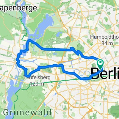
Start und Ziel der Strecke befindet sich direkt am Brandenburger Tor. Daneben bindet der Kurs, wie schon im Vorjahr, auch wieder wichtige Sehenswürdigkeiten, wie Reichstagsgebäude, Potsdamer Platz, Schloss Charlottenburg, Flughafen Tempelhof, Oberbaumbrücke, East Side Gallery, Schloss Bellevue und Siegessäule, ein.<br />Neu ist, dass die Strecke auf der 120km-Runde statt nach Reinickendorf und Hennigsdorf nun in den Berliner Süden sowie über malerische Alleen durch das angrenzende Land Brandenburg führt. Zudem stehen für die Teilnehmer beider Distanzen die Havelchaussee mit dem „Anstieg“ zum Kaiser Wilhelm Gedächtnisturm sowie Kronprinzessinnenweg auf dem Programm. Damit wird das größte Naherholungsgebiet Berlins, der Grunewald, der gleichzeitig Berlins wohl beliebtestes Radsport-Trainingsrevier ist, mit einbezogen. (von Skoda-Velothon-Berlin 2009)
- -:--
- Duration
- 115.2 km
- Distance
- 211 m
- Ascent
- 212 m
- Descent
- ---
- Avg. speed
- 68 m
- Avg. speed

Route quality
Waytypes & surfaces along the route
Waytypes
Busy road
31.8 km
(28 %)
Road
25.6 km
(22 %)
Surfaces
Paved
107.3 km
(93 %)
Unpaved
0.7 km
(<1 %)
Asphalt
90.5 km
(79 %)
Paving stones
14.5 km
(13 %)
Continue with Bikemap
Use, edit, or download this cycling route
You would like to ride Skoda Velothon 2009 (120km) or customize it for your own trip? Here is what you can do with this Bikemap route:
Free features
- Save this route as favorite or in collections
- Copy & plan your own version of this route
- Sync your route with Garmin or Wahoo
Premium features
Free trial for 3 days, or one-time payment. More about Bikemap Premium.
- Navigate this route on iOS & Android
- Export a GPX / KML file of this route
- Create your custom printout (try it for free)
- Download this route for offline navigation
Discover more Premium features.
Get Bikemap PremiumFrom our community
Other popular routes starting in Tiergarten
 Velothon 2009
- Distance
- 122.7 km
- Ascent
- 272 m
- Descent
- 274 m
- Location
- Tiergarten, Land Berlin, Germany
 Die Route fürs Alleycat/Groupride
- Distance
- 144.4 km
- Ascent
- 304 m
- Descent
- 252 m
- Location
- Tiergarten, Land Berlin, Germany
 D Berlin HBF-Hackescher Markt
- Distance
- 3.8 km
- Ascent
- 53 m
- Descent
- 30 m
- Location
- Tiergarten, Land Berlin, Germany
 Wannsee round
- Distance
- 70.4 km
- Ascent
- 288 m
- Descent
- 291 m
- Location
- Tiergarten, Land Berlin, Germany
 Spree,Havel und Hohenzollernkanal
- Distance
- 33.2 km
- Ascent
- 35 m
- Descent
- 35 m
- Location
- Tiergarten, Land Berlin, Germany
 2014 Skoda Velothon Berlin 120 km
- Distance
- 117.7 km
- Ascent
- 173 m
- Descent
- 175 m
- Location
- Tiergarten, Land Berlin, Germany
 Mauerradweg
- Distance
- 171.7 km
- Ascent
- 169 m
- Descent
- 171 m
- Location
- Tiergarten, Land Berlin, Germany
 Trainingsstrecke "aktivcenter"
- Distance
- 45.6 km
- Ascent
- 152 m
- Descent
- 152 m
- Location
- Tiergarten, Land Berlin, Germany
Open it in the app