

MTB Zabelstein Trails
A cycling route starting in Gerolzhofen, Bavaria, Germany.
Overview
About this route
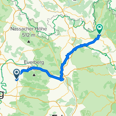
Tour zum Zabelstein mit Trails am Böhlgrund
- -:--
- Duration
- 44 km
- Distance
- 604 m
- Ascent
- 602 m
- Descent
- ---
- Avg. speed
- ---
- Avg. speed

Continue with Bikemap
Use, edit, or download this cycling route
You would like to ride MTB Zabelstein Trails or customize it for your own trip? Here is what you can do with this Bikemap route:
Free features
- Save this route as favorite or in collections
- Copy & plan your own version of this route
- Sync your route with Garmin or Wahoo
Premium features
Free trial for 3 days, or one-time payment. More about Bikemap Premium.
- Navigate this route on iOS & Android
- Export a GPX / KML file of this route
- Create your custom printout (try it for free)
- Download this route for offline navigation
Discover more Premium features.
Get Bikemap PremiumFrom our community
Other popular routes starting in Gerolzhofen
 Mainrunde
- Distance
- 56.1 km
- Ascent
- 197 m
- Descent
- 195 m
- Location
- Gerolzhofen, Bavaria, Germany
 Ossitour die Zweite Part three
- Distance
- 116.4 km
- Ascent
- 226 m
- Descent
- 161 m
- Location
- Gerolzhofen, Bavaria, Germany
 Geo- Zell-Geo über Schlangenweg
- Distance
- 46.9 km
- Ascent
- 506 m
- Descent
- 502 m
- Location
- Gerolzhofen, Bavaria, Germany
 MTB Runde Vorschlag
- Distance
- 27 km
- Ascent
- 517 m
- Descent
- 518 m
- Location
- Gerolzhofen, Bavaria, Germany
 Geo-Kitzingen-Geo
- Distance
- 78.5 km
- Ascent
- 361 m
- Descent
- 361 m
- Location
- Gerolzhofen, Bavaria, Germany
 Kurze Steigerwald Runde
- Distance
- 33.8 km
- Ascent
- 411 m
- Descent
- 415 m
- Location
- Gerolzhofen, Bavaria, Germany
 Geo-Haßfurt-Schweinfurt-Geo
- Distance
- 75 km
- Ascent
- 255 m
- Descent
- 281 m
- Location
- Gerolzhofen, Bavaria, Germany
 kleine Rund Geo Süd
- Distance
- 25.7 km
- Ascent
- 134 m
- Descent
- 138 m
- Location
- Gerolzhofen, Bavaria, Germany
Open it in the app