

moja prva vacsia trasa, dost som sa natrapil
A cycling route starting in Trenčianske Teplice, Nitriansky kraj, Slovak Republic.
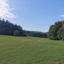
Overview
About this route
siel som na futbal, do nemsovej takze som to absolvoval cele 2 krat. neprijemne je stupanie na machnaci, ktore ma podla tabul 14%. neprijemne je ist aj po slačoch(kopec medzi krasnou vsou a motesicami), tiez dost prudky, v smere od krasnej vsi
- -:--
- Duration
- 27.8 km
- Distance
- 284 m
- Ascent
- 346 m
- Descent
- ---
- Avg. speed
- ---
- Avg. speed
Route quality
Waytypes & surfaces along the route
Waytypes
Busy road
17.3 km
(62 %)
Road
5.5 km
(20 %)
Surfaces
Paved
23.5 km
(85 %)
Asphalt
23.4 km
(84 %)
Concrete
0.1 km
(<1 %)
Continue with Bikemap
Use, edit, or download this cycling route
You would like to ride moja prva vacsia trasa, dost som sa natrapil or customize it for your own trip? Here is what you can do with this Bikemap route:
Free features
- Save this route as favorite or in collections
- Copy & plan your own version of this route
- Sync your route with Garmin or Wahoo
Premium features
Free trial for 3 days, or one-time payment. More about Bikemap Premium.
- Navigate this route on iOS & Android
- Export a GPX / KML file of this route
- Create your custom printout (try it for free)
- Download this route for offline navigation
Discover more Premium features.
Get Bikemap PremiumFrom our community
Other popular routes starting in Trenčianske Teplice
 Trenč.Teplice-Trenč.Teplá - Nemšová
- Distance
- 11.2 km
- Ascent
- 13 m
- Descent
- 57 m
- Location
- Trenčianske Teplice, Nitriansky kraj, Slovak Republic
 TN MTB #1
- Distance
- 52.8 km
- Ascent
- 1,091 m
- Descent
- 1,091 m
- Location
- Trenčianske Teplice, Nitriansky kraj, Slovak Republic
 Trenčianske Teplice Radfahren
- Distance
- 42.1 km
- Ascent
- 560 m
- Descent
- 558 m
- Location
- Trenčianske Teplice, Nitriansky kraj, Slovak Republic
 Soblahovská chata-Trenčín
- Distance
- 12.6 km
- Ascent
- 131 m
- Descent
- 475 m
- Location
- Trenčianske Teplice, Nitriansky kraj, Slovak Republic
 Kúpeľný duatlon Trenčianske Teplice
- Distance
- 20 km
- Ascent
- 371 m
- Descent
- 372 m
- Location
- Trenčianske Teplice, Nitriansky kraj, Slovak Republic
 Omšenie - Omšenská Baba - Omšenie
- Distance
- 4.4 km
- Ascent
- 323 m
- Descent
- 321 m
- Location
- Trenčianske Teplice, Nitriansky kraj, Slovak Republic
 Homôlka-Zliechov-Mojtín-Košecké Podhradie-Iliavka-Dubnica.
- Distance
- 51.6 km
- Ascent
- 1,770 m
- Descent
- 2,164 m
- Location
- Trenčianske Teplice, Nitriansky kraj, Slovak Republic
 17. novembra 37 do 17. novembra 290
- Distance
- 35.1 km
- Ascent
- 372 m
- Descent
- 441 m
- Location
- Trenčianske Teplice, Nitriansky kraj, Slovak Republic
Open it in the app