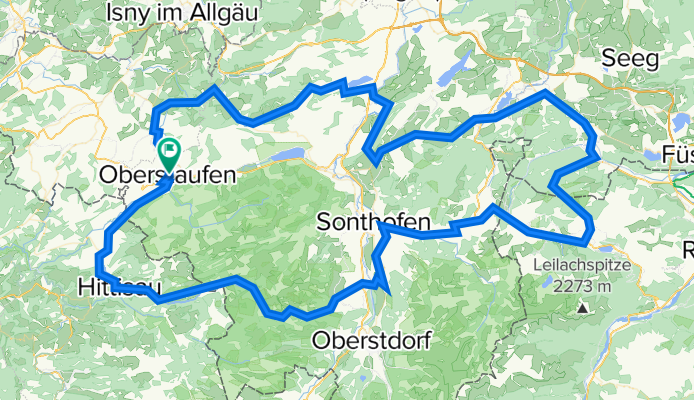
Königsetappe im Allgäu (Oberstaufen - Tannheimer Tal - Oberstaufen)
A cycling route starting in Oberstaufen, Bavaria, Germany.
Overview
About this route
oberstaufen - ach - krumbach - hittisau - balderschwang - riedbergpass - obermaiselstein - fischen - oberthalhofen - hinang - altstädten - beilenberg - margarethen - sonthofen - bad hindelang - oberjochpass - schattwald - zöblen - tannheim - grän - pfronten - nesselwang - wertach - kranzegg - rettenberg - weiher - humbach - rottach - häusern - martinszell - oberdorf - niedersonthofen - rieggis - diepolz - missen - ebratshofen - harbratshofen - stiefenhofen - wolfsried - oberstaufen
- -:--
- Duration
- 166.7 km
- Distance
- 2,889 m
- Ascent
- 2,843 m
- Descent
- ---
- Avg. speed
- 1,410 m
- Avg. speed
Route quality
Waytypes & surfaces along the route
Waytypes
Busy road
61.6 km
(37 %)
Road
57 km
(34 %)
Surfaces
Paved
144.5 km
(87 %)
Unpaved
2.6 km
(2 %)
Asphalt
143.9 km
(86 %)
Gravel
2.2 km
(1 %)
Continue with Bikemap
Use, edit, or download this cycling route
You would like to ride Königsetappe im Allgäu (Oberstaufen - Tannheimer Tal - Oberstaufen) or customize it for your own trip? Here is what you can do with this Bikemap route:
Free features
- Save this route as favorite or in collections
- Copy & plan your own version of this route
- Sync your route with Garmin or Wahoo
Premium features
Free trial for 3 days, or one-time payment. More about Bikemap Premium.
- Navigate this route on iOS & Android
- Export a GPX / KML file of this route
- Create your custom printout (try it for free)
- Download this route for offline navigation
Discover more Premium features.
Get Bikemap PremiumFrom our community
Other popular routes starting in Oberstaufen
 Am Kalvarienberg nach Am Kalvarienberg
- Distance
- 53.8 km
- Ascent
- 548 m
- Descent
- 561 m
- Location
- Oberstaufen, Bavaria, Germany
 Rund um den Alpsee - Biketour 42 km-900 hm
- Distance
- 42.1 km
- Ascent
- 960 m
- Descent
- 960 m
- Location
- Oberstaufen, Bavaria, Germany
 10. Oberstaufen-Kriessern-80km-500Hm
- Distance
- 80.8 km
- Ascent
- 527 m
- Descent
- 911 m
- Location
- Oberstaufen, Bavaria, Germany
 Alpsee-Panorama
- Distance
- 35.1 km
- Ascent
- 597 m
- Descent
- 597 m
- Location
- Oberstaufen, Bavaria, Germany
 Oberstaufen,Eglofs,Moos,Hochberg, zurück
- Distance
- 54 km
- Ascent
- 860 m
- Descent
- 859 m
- Location
- Oberstaufen, Bavaria, Germany
 Oberstaufen,Eglofs,Moos,Hochberg, zurück
- Distance
- 54 km
- Ascent
- 860 m
- Descent
- 859 m
- Location
- Oberstaufen, Bavaria, Germany
 Oberstaufen-Rohrmoss-Oberstaufen
- Distance
- 82.4 km
- Ascent
- 834 m
- Descent
- 834 m
- Location
- Oberstaufen, Bavaria, Germany
 Hündle_Alpsee
- Distance
- 19.3 km
- Ascent
- 667 m
- Descent
- 689 m
- Location
- Oberstaufen, Bavaria, Germany
Open it in the app

