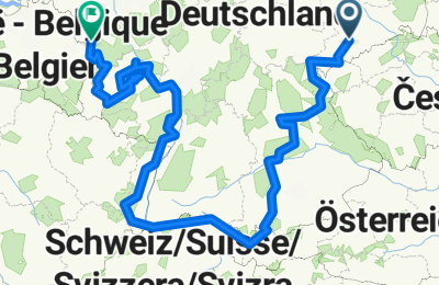
Cycling Route in Neukirchen, Saxony, Germany
Süddeutschland 2011

Open this route in the Bikemap app

Open this route in Bikemap Web
Distance
Ascent
Descent
Duration
Avg. Speed
Max. Elevation
Cycling Route in Neukirchen, Saxony, Germany

Open this route in the Bikemap app

Open this route in Bikemap Web
Route noch in Bearbeitung, endet in Aachen
Gefahrene km: 2880
Dauer: 56 Tage
Durchschnittliche Tourenlänge: 41 km
Durchschnittliche Tourenlänge - nur Fahrtage: 67 km
Längste Tagesetappe: 107 km
Höchster Punkt: 1675 m - Hochtannbergpass zwischen Lechtal und Bregenzer Wald
Gewicht Gepäck: 22 kg (ohen Essen, mit 1kg-Kamera)
Gewicht Fahrer: vorher: 91 kg, nachher: 84 kg

Did you know? You can use this route as a template in our cycling route planner if you don't wish to start from scratch. Customize it based on your needs to plan your perfect cycling tour.
Open it in the app