

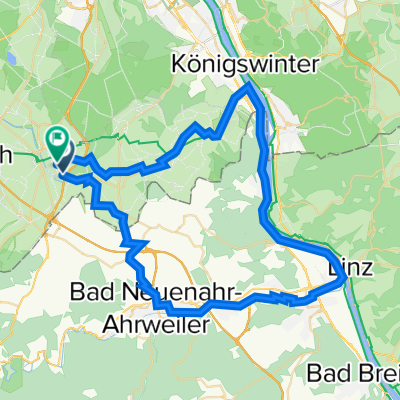
Merl-Kottenforst-Buschhoven-Swist-Villiprott-Merl
A cycling route starting in Meckenheim, North Rhine-Westphalia, Germany.
Overview
About this route
Die Route führt vom Merler Dorfplatz (Meckenheim) durch den Kottenforst in die Gegend um Buschhoven. Von dort geht es an der Swist entlang wieder nach Merl.
Die Schleife über Villiprott führt zum Biergarten "Waldesruh" und kann natürlich ausgelassen werden... :-(<br /><br />Der Weg führt vorbei am Bahnhof Kottenforst, an der Aussichtsplattform der Quarzwerke Witterschlick, am "Eisernen Mann", dem Rest einer römischen Wasserleitung, der Wasserburg Morenhoven sowie der Burg Münchhausen.<br /><br />Die Strecke ist auch mit einem Trekkingrad zu bewältigen.
- -:--
- Duration
- 46.4 km
- Distance
- 162 m
- Ascent
- 161 m
- Descent
- ---
- Avg. speed
- ---
- Avg. speed
Route quality
Waytypes & surfaces along the route
Waytypes
Track
24.3 km
(53 %)
Path
12.7 km
(27 %)
Surfaces
Paved
18.1 km
(39 %)
Unpaved
22.3 km
(48 %)
Asphalt
13.8 km
(30 %)
Pebblestone
13.2 km
(28 %)
Continue with Bikemap
Use, edit, or download this cycling route
You would like to ride Merl-Kottenforst-Buschhoven-Swist-Villiprott-Merl or customize it for your own trip? Here is what you can do with this Bikemap route:
Free features
- Save this route as favorite or in collections
- Copy & plan your own version of this route
- Sync your route with Garmin or Wahoo
Premium features
Free trial for 3 days, or one-time payment. More about Bikemap Premium.
- Navigate this route on iOS & Android
- Export a GPX / KML file of this route
- Create your custom printout (try it for free)
- Download this route for offline navigation
Discover more Premium features.
Get Bikemap PremiumFrom our community
Other popular routes starting in Meckenheim
 Trainingsrunde Meckem-Pech-Berkum
- Distance
- 44 km
- Ascent
- 485 m
- Descent
- 485 m
- Location
- Meckenheim, North Rhine-Westphalia, Germany
 Small round south of Bonn, Germany
- Distance
- 58.4 km
- Ascent
- 300 m
- Descent
- 290 m
- Location
- Meckenheim, North Rhine-Westphalia, Germany
 Meckenheim - Rech
- Distance
- 44.7 km
- Ascent
- 760 m
- Descent
- 760 m
- Location
- Meckenheim, North Rhine-Westphalia, Germany
 Tomburg
- Distance
- 9.7 km
- Ascent
- 119 m
- Descent
- 21 m
- Location
- Meckenheim, North Rhine-Westphalia, Germany
 Rheintal: Wine, Rhine and Romans
- Distance
- 266.2 km
- Ascent
- 6,602 m
- Descent
- 6,603 m
- Location
- Meckenheim, North Rhine-Westphalia, Germany
 Kleine Kottenforst Runde
- Distance
- 25.5 km
- Ascent
- 99 m
- Descent
- 96 m
- Location
- Meckenheim, North Rhine-Westphalia, Germany
 Kottenforst-Ville
- Distance
- 62.3 km
- Ascent
- 106 m
- Descent
- 227 m
- Location
- Meckenheim, North Rhine-Westphalia, Germany
 Kottenforst-Runde
- Distance
- 18.5 km
- Ascent
- 104 m
- Descent
- 104 m
- Location
- Meckenheim, North Rhine-Westphalia, Germany
Open it in the app