

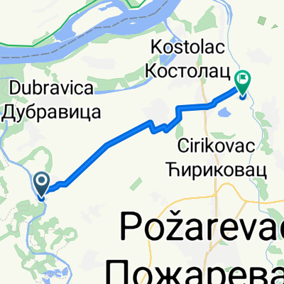
Kostolac-Gornjak-Zagubica-Laznica = "Le Tour de Homolje"
A cycling route starting in Požarevac, Central Serbia, Serbia.
Overview
About this route
- -:--
- Duration
- 101.9 km
- Distance
- 685 m
- Ascent
- 399 m
- Descent
- ---
- Avg. speed
- ---
- Avg. speed

Route quality
Waytypes & surfaces along the route
Waytypes
Busy road
61.7 km
(61 %)
Quiet road
25.4 km
(25 %)
Surfaces
Paved
30.5 km
(30 %)
Unpaved
4.8 km
(5 %)
Asphalt
30.5 km
(30 %)
Unpaved (undefined)
4.8 km
(5 %)
Undefined
66.6 km
(65 %)
Continue with Bikemap
Use, edit, or download this cycling route
You would like to ride Kostolac-Gornjak-Zagubica-Laznica = "Le Tour de Homolje" or customize it for your own trip? Here is what you can do with this Bikemap route:
Free features
- Save this route as favorite or in collections
- Copy & plan your own version of this route
- Sync your route with Garmin or Wahoo
Premium features
Free trial for 3 days, or one-time payment. More about Bikemap Premium.
- Navigate this route on iOS & Android
- Export a GPX / KML file of this route
- Create your custom printout (try it for free)
- Download this route for offline navigation
Discover more Premium features.
Get Bikemap PremiumFrom our community
Other popular routes starting in Požarevac
 Požarevac-Doljni Milanovac-Mosna
- Distance
- 107.3 km
- Ascent
- 2,011 m
- Descent
- 2,005 m
- Location
- Požarevac, Central Serbia, Serbia
 Požarevac-Beljanica-Žagubica
- Distance
- 129.3 km
- Ascent
- 1,419 m
- Descent
- 1,139 m
- Location
- Požarevac, Central Serbia, Serbia
 12.diena Dubovac to Belgrad 81km
- Distance
- 97.8 km
- Ascent
- 242 m
- Descent
- 220 m
- Location
- Požarevac, Central Serbia, Serbia
 Brezane -rukumija
- Distance
- 14.9 km
- Ascent
- 98 m
- Descent
- 75 m
- Location
- Požarevac, Central Serbia, Serbia
 19.05.2013 od 09.00 do 12.45
- Distance
- 18.8 km
- Ascent
- 254 m
- Descent
- 254 m
- Location
- Požarevac, Central Serbia, Serbia
 Homolje 2013-7
- Distance
- 207.8 km
- Ascent
- 1,335 m
- Descent
- 1,336 m
- Location
- Požarevac, Central Serbia, Serbia
 manastir bradacha
- Distance
- 70.5 km
- Ascent
- 483 m
- Descent
- 481 m
- Location
- Požarevac, Central Serbia, Serbia
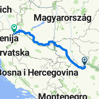 Do Slovenije preko Madjarske
- Distance
- 632.5 km
- Ascent
- 691 m
- Descent
- 548 m
- Location
- Požarevac, Central Serbia, Serbia
Open it in the app