

Rabbit Hash / Big Bone Loop
A cycling route starting in Union, Kentucky, United States of America.
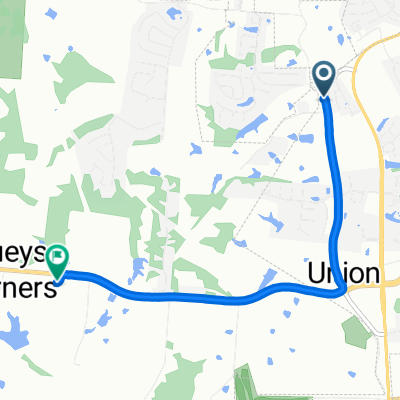
Overview
About this route
Stop off at Rabbit Hash for a visit to the general store or wine tasting. Summer weekends have BBQ. Continue on to Big Bone whare Jane's Restaurant serves up food on weekends. Lastly stop off at Big Bone Lick State Park.
- -:--
- Duration
- 55.7 km
- Distance
- 362 m
- Ascent
- 361 m
- Descent
- ---
- Avg. speed
- ---
- Avg. speed
Route quality
Waytypes & surfaces along the route
Waytypes
Quiet road
28.5 km
(51 %)
Busy road
22.3 km
(40 %)
Surfaces
Paved
12.7 km
(23 %)
Paved (undefined)
12.7 km
(23 %)
Undefined
43 km
(77 %)
Continue with Bikemap
Use, edit, or download this cycling route
You would like to ride Rabbit Hash / Big Bone Loop or customize it for your own trip? Here is what you can do with this Bikemap route:
Free features
- Save this route as favorite or in collections
- Copy & plan your own version of this route
- Sync your route with Garmin or Wahoo
Premium features
Free trial for 3 days, or one-time payment. More about Bikemap Premium.
- Navigate this route on iOS & Android
- Export a GPX / KML file of this route
- Create your custom printout (try it for free)
- Download this route for offline navigation
Discover more Premium features.
Get Bikemap PremiumFrom our community
Other popular routes starting in Union
 9118 Old Union Rd, Union to 2677 Hathaway Rd, Union
- Distance
- 4.8 km
- Ascent
- 68 m
- Descent
- 42 m
- Location
- Union, Kentucky, United States of America
 Dixie Highway 10665, Walton to Frogtown Connector Road 12929, Walton
- Distance
- 14.5 km
- Ascent
- 68 m
- Descent
- 47 m
- Location
- Union, Kentucky, United States of America
 9190 Camp Ernst Rd, Union to 9190 Camp Ernst Rd, Union
- Distance
- 44.2 km
- Ascent
- 810 m
- Descent
- 809 m
- Location
- Union, Kentucky, United States of America
 9190 Camp Ernst Rd, Union to 9190 Camp Ernst Rd, Union
- Distance
- 10.9 km
- Ascent
- 44 m
- Descent
- 44 m
- Location
- Union, Kentucky, United States of America
 Rampart Way, Florence to 2290 Antoinette Way, Florence
- Distance
- 28.9 km
- Ascent
- 435 m
- Descent
- 442 m
- Location
- Union, Kentucky, United States of America
 Rabbit Hash / Big Bone Loop
- Distance
- 55.7 km
- Ascent
- 362 m
- Descent
- 361 m
- Location
- Union, Kentucky, United States of America
 9190 Camp Ernst Rd, Union to 9190 Camp Ernst Rd, Union
- Distance
- 9.4 km
- Ascent
- 32 m
- Descent
- 31 m
- Location
- Union, Kentucky, United States of America
 9118 Old Union Rd, Union to 2677 Hathaway Rd, Union
- Distance
- 4.7 km
- Ascent
- 59 m
- Descent
- 30 m
- Location
- Union, Kentucky, United States of America
Open it in the app