

Jena - Halle (Saale-Radweg)
A cycling route starting in Jena, Free State of Thuringia, Germany.
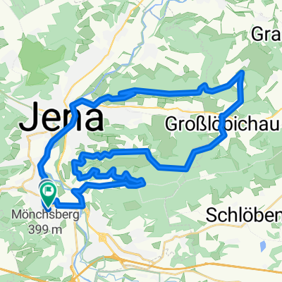
Overview
About this route
Die Strecke enthält einige Umwege, da der Saale-Radweg manchmal schlecht ausgeschildert ist.
- -:--
- Duration
- 137.9 km
- Distance
- 289 m
- Ascent
- 357 m
- Descent
- ---
- Avg. speed
- ---
- Avg. speed
Route quality
Waytypes & surfaces along the route
Waytypes
Quiet road
38.4 km
(28 %)
Track
27.2 km
(20 %)
Surfaces
Paved
106.8 km
(77 %)
Unpaved
11.9 km
(9 %)
Asphalt
94.4 km
(68 %)
Gravel
9.8 km
(7 %)
Continue with Bikemap
Use, edit, or download this cycling route
You would like to ride Jena - Halle (Saale-Radweg) or customize it for your own trip? Here is what you can do with this Bikemap route:
Free features
- Save this route as favorite or in collections
- Copy & plan your own version of this route
- Sync your route with Garmin or Wahoo
Premium features
Free trial for 3 days, or one-time payment. More about Bikemap Premium.
- Navigate this route on iOS & Android
- Export a GPX / KML file of this route
- Create your custom printout (try it for free)
- Download this route for offline navigation
Discover more Premium features.
Get Bikemap PremiumFrom our community
Other popular routes starting in Jena
 4. Etappe Tour de Saale Jena - Naumburg
- Distance
- 55.7 km
- Ascent
- 405 m
- Descent
- 439 m
- Location
- Jena, Free State of Thuringia, Germany
 : Halbtagestour mit Kindern
- Distance
- 29.6 km
- Ascent
- 185 m
- Descent
- 201 m
- Location
- Jena, Free State of Thuringia, Germany
 Jena-Stadtroda-Jena
- Distance
- 34.6 km
- Ascent
- 280 m
- Descent
- 251 m
- Location
- Jena, Free State of Thuringia, Germany
 Trainingsrunde
- Distance
- 34.9 km
- Ascent
- 559 m
- Descent
- 558 m
- Location
- Jena, Free State of Thuringia, Germany
 2. Rad n Roll MTB Marathon
- Distance
- 28.6 km
- Ascent
- 607 m
- Descent
- 494 m
- Location
- Jena, Free State of Thuringia, Germany
 Klein aber Fein
- Distance
- 32.9 km
- Ascent
- 335 m
- Descent
- 293 m
- Location
- Jena, Free State of Thuringia, Germany
 Jena - Leuchtenburg/St. Ganloff
- Distance
- 91.1 km
- Ascent
- 585 m
- Descent
- 585 m
- Location
- Jena, Free State of Thuringia, Germany
 Forst/Ammerbach
- Distance
- 14.2 km
- Ascent
- 291 m
- Descent
- 291 m
- Location
- Jena, Free State of Thuringia, Germany
Open it in the app