
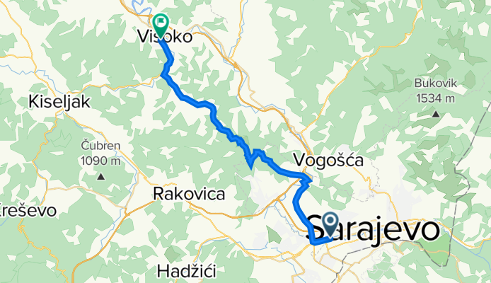
Sarajevo - Visoko (hard way)
A cycling route starting in Sarajevo, Federation of Bosnia and Herzegovina, Bosnia and Herzegovina.
Overview
About this route
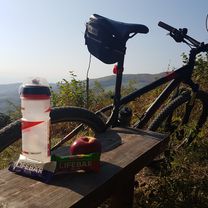
Ruta od ASA auta na Alipasinu do Visokog, preko brda i dolina, makadamom i asfaltom, dijelom i kroz sumu... Povratak opcionalan :)
- -:--
- Duration
- 28 km
- Distance
- 454 m
- Ascent
- 529 m
- Descent
- ---
- Avg. speed
- ---
- Max. altitude

Route highlights
Points of interest along the route
Point of interest after 0 km
ASA auto
Point of interest after 8.2 km
Reljevo
Point of interest after 15.8 km
Bioca
Point of interest after 22 km
Dvor
Point of interest after 23.7 km
Dautovci
Point of interest after 28 km
Visoko
Continue with Bikemap
Use, edit, or download this cycling route
You would like to ride Sarajevo - Visoko (hard way) or customize it for your own trip? Here is what you can do with this Bikemap route:
Free features
- Save this route as favorite or in collections
- Copy & plan your own version of this route
- Sync your route with Garmin or Wahoo
Premium features
Free trial for 3 days, or one-time payment. More about Bikemap Premium.
- Navigate this route on iOS & Android
- Export a GPX / KML file of this route
- Create your custom printout (try it for free)
- Download this route for offline navigation
Discover more Premium features.
Get Bikemap PremiumFrom our community
Other popular routes starting in Sarajevo
 lukavica>tvrdimići>jasik&>brus>bistrik kula
- Distance
- 45.3 km
- Ascent
- 1,519 m
- Descent
- 1,517 m
- Location
- Sarajevo, Federation of Bosnia and Herzegovina, Bosnia and Herzegovina
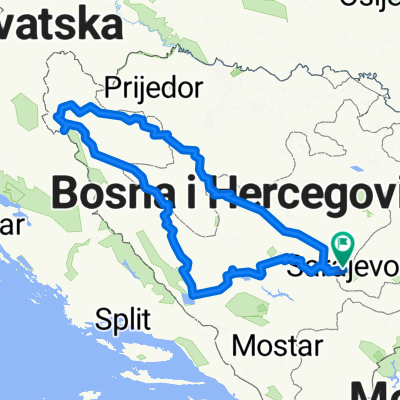 Giro di West Bosnia
- Distance
- 797.6 km
- Ascent
- 19,774 m
- Descent
- 19,773 m
- Location
- Sarajevo, Federation of Bosnia and Herzegovina, Bosnia and Herzegovina
 Geteova, Sarajevo to Geteova, Sarajevo
- Distance
- 8.1 km
- Ascent
- 86 m
- Descent
- 90 m
- Location
- Sarajevo, Federation of Bosnia and Herzegovina, Bosnia and Herzegovina
 Alipasino - Barice (hardway)
- Distance
- 12.1 km
- Ascent
- 545 m
- Descent
- 63 m
- Location
- Sarajevo, Federation of Bosnia and Herzegovina, Bosnia and Herzegovina
 Ahmeta Ljubunčića, Ilidža to Hadzici
- Distance
- 14.9 km
- Ascent
- 195 m
- Descent
- 146 m
- Location
- Sarajevo, Federation of Bosnia and Herzegovina, Bosnia and Herzegovina
 From Sarajevo to Visoko
- Distance
- 55.3 km
- Ascent
- 1,350 m
- Descent
- 1,441 m
- Location
- Sarajevo, Federation of Bosnia and Herzegovina, Bosnia and Herzegovina
 Voyage de malade
- Distance
- 1,793.6 km
- Ascent
- 2,905 m
- Descent
- 3,212 m
- Location
- Sarajevo, Federation of Bosnia and Herzegovina, Bosnia and Herzegovina
 ilidza - hum
- Distance
- 28.1 km
- Ascent
- 413 m
- Descent
- 414 m
- Location
- Sarajevo, Federation of Bosnia and Herzegovina, Bosnia and Herzegovina
Open it in the app