

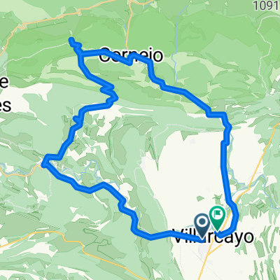
BCB. 10º Aniversario (2). San Pantaleón de Losa-Lobera de Pérex-San Pantaleón de Losa
A cycling route starting in Medina de Pomar, Castille and León, Spain.
Overview
About this route
<span style="color: #333333; font-family: 'Helvetica Neue', Helvetica, Arial, sans-serif; font-size: 19px; line-height: 30px; white-space: pre-wrap;">Circular. Ruta idónea para hacer en una mañana. Paisajes espectaculares. Cultural, Monumental y Paisajística. Se va desde Pantaleón de Losa hasta la Lobera de Pérex. Después se sube a la Ermita de SAn Pataleón, románica y con cierto interés histórico. El camino de vuelta desde Pérex hasta San Pantaleón lo hicimos tomando como alternativa un sendero de la GR 85.</span>
- -:--
- Duration
- 19.3 km
- Distance
- 358 m
- Ascent
- 361 m
- Descent
- ---
- Avg. speed
- ---
- Avg. speed

Route quality
Waytypes & surfaces along the route
Waytypes
Track
8.6 km
(44 %)
Road
5.1 km
(26 %)
Surfaces
Paved
9.3 km
(48 %)
Unpaved
7.5 km
(39 %)
Asphalt
8.7 km
(45 %)
Ground
5.5 km
(28 %)
Route highlights
Points of interest along the route
. San Pantaleón de Losa-Lobera de Pérex-San Pantaleón de Losa\"")
Point of interest after 3.1 km
Quintanilla la Ojada
. San Pantaleón de Losa-Lobera de Pérex-San Pantaleón de Losa\"")
Point of interest after 7.1 km
. San Pantaleón de Losa-Lobera de Pérex-San Pantaleón de Losa\"")
Point of interest after 10.2 km
Lobera de Pérex
. San Pantaleón de Losa-Lobera de Pérex-San Pantaleón de Losa\"")
Point of interest after 10.4 km
Vistas desde la lobera de Pérex
. San Pantaleón de Losa-Lobera de Pérex-San Pantaleón de Losa\"")
Point of interest after 10.4 km
Vistas desde la lobera de Pérex
. San Pantaleón de Losa-Lobera de Pérex-San Pantaleón de Losa\"")
Point of interest after 11.2 km
Lobera de Pérex
. San Pantaleón de Losa-Lobera de Pérex-San Pantaleón de Losa\"")
Point of interest after 14.8 km
Posible confusión. El camino de bajada de la lobera, en esta zona, es la GR 85. En este punto se pierde, hay confusión, pasa bordeando una tierra de cultivo. Hay que analizar bien el track en la vista de satélite.
. San Pantaleón de Losa-Lobera de Pérex-San Pantaleón de Losa\"")
Point of interest after 16.7 km
Descenso de la lobera de Pérex a San Pantaleón
. San Pantaleón de Losa-Lobera de Pérex-San Pantaleón de Losa\"")
Point of interest after 17.2 km
Subida a la ermita de San Pantaleón
. San Pantaleón de Losa-Lobera de Pérex-San Pantaleón de Losa\"")
Point of interest after 17.6 km
San Pantaleón de Losa
Continue with Bikemap
Use, edit, or download this cycling route
You would like to ride BCB. 10º Aniversario (2). San Pantaleón de Losa-Lobera de Pérex-San Pantaleón de Losa or customize it for your own trip? Here is what you can do with this Bikemap route:
Free features
- Save this route as favorite or in collections
- Copy & plan your own version of this route
- Sync your route with Garmin or Wahoo
Premium features
Free trial for 3 days, or one-time payment. More about Bikemap Premium.
- Navigate this route on iOS & Android
- Export a GPX / KML file of this route
- Create your custom printout (try it for free)
- Download this route for offline navigation
Discover more Premium features.
Get Bikemap PremiumFrom our community
Other popular routes starting in Medina de Pomar
 BCB. Valle de Manzanedo
- Distance
- 18.4 km
- Ascent
- 559 m
- Descent
- 463 m
- Location
- Medina de Pomar, Castille and León, Spain
 BCB. Las Merindades por cuatro rios
- Distance
- 59.4 km
- Ascent
- 812 m
- Descent
- 813 m
- Location
- Medina de Pomar, Castille and León, Spain
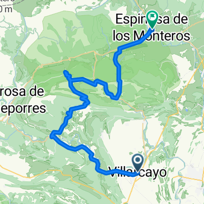
 villarcayo - espinosa
- Distance
- 48.2 km
- Ascent
- 712 m
- Descent
- 718 m
- Location
- Medina de Pomar, Castille and León, Spain
 Merindadeak Medinatik 1. eguna
- Distance
- 47.1 km
- Ascent
- 300 m
- Descent
- 296 m
- Location
- Medina de Pomar, Castille and León, Spain
 OndaCero BCB. Bici y baño 3. Puentedey
- Distance
- 43.6 km
- Ascent
- 405 m
- Descent
- 407 m
- Location
- Medina de Pomar, Castille and León, Spain
 BCB. Morciencuentros 4. Villarcayo-Espinosa de los Monteros
- Distance
- 44.4 km
- Ascent
- 560 m
- Descent
- 403 m
- Location
- Medina de Pomar, Castille and León, Spain
 De ?d›˛? a ?d›˛?
- Distance
- 10.7 km
- Ascent
- 102 m
- Descent
- 140 m
- Location
- Medina de Pomar, Castille and León, Spain
 OIncinillas
- Distance
- 8.7 km
- Ascent
- 337 m
- Descent
- 398 m
- Location
- Medina de Pomar, Castille and León, Spain
Open it in the app