

über Wermelskirchen und Schloss Burg nach Düsseldorf und über Monheim und Opladen nach Hause
A cycling route starting in Burscheid, North Rhine-Westphalia, Germany.
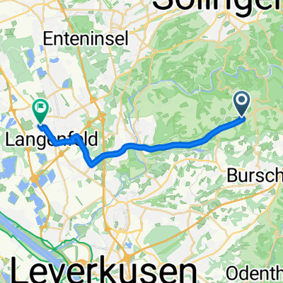
Overview
About this route
Burscheid-Hilgen - Wermelskirchen - Schloss Burg - an der Wupper bis Wipperkotten - durch die Dörfer nach Langenfeld - Düsseldorf (Urdenbach) - Monheim - Langenfeld - Opladen - B232 bis Kuckenberg - Radwanderweg "Balkantrasse" (leider nicht auf der Karte; Einstieg ist an der Bushaltestelle "Kuckenberg" der Linien 239/240) bis Burscheid-Hilgen
- -:--
- Duration
- 78.8 km
- Distance
- 370 m
- Ascent
- 367 m
- Descent
- ---
- Avg. speed
- ---
- Avg. speed
Route quality
Waytypes & surfaces along the route
Waytypes
Busy road
25.5 km
(32 %)
Quiet road
20.3 km
(26 %)
Surfaces
Paved
61 km
(77 %)
Unpaved
5.7 km
(7 %)
Asphalt
56.6 km
(72 %)
Gravel
4.5 km
(6 %)
Continue with Bikemap
Use, edit, or download this cycling route
You would like to ride über Wermelskirchen und Schloss Burg nach Düsseldorf und über Monheim und Opladen nach Hause or customize it for your own trip? Here is what you can do with this Bikemap route:
Free features
- Save this route as favorite or in collections
- Copy & plan your own version of this route
- Sync your route with Garmin or Wahoo
Premium features
Free trial for 3 days, or one-time payment. More about Bikemap Premium.
- Navigate this route on iOS & Android
- Export a GPX / KML file of this route
- Create your custom printout (try it for free)
- Download this route for offline navigation
Discover more Premium features.
Get Bikemap PremiumFrom our community
Other popular routes starting in Burscheid
 Restaurant Rusticus - Langenfeld
- Distance
- 14.5 km
- Ascent
- 27 m
- Descent
- 180 m
- Location
- Burscheid, North Rhine-Westphalia, Germany
 Dhüntalsperre - kleine Runde
- Distance
- 26 km
- Ascent
- 451 m
- Descent
- 452 m
- Location
- Burscheid, North Rhine-Westphalia, Germany
 Dabringhausen
- Distance
- 23.2 km
- Ascent
- 308 m
- Descent
- 310 m
- Location
- Burscheid, North Rhine-Westphalia, Germany
 Rundweg Sengbachtalsperre
- Distance
- 10.4 km
- Ascent
- 240 m
- Descent
- 238 m
- Location
- Burscheid, North Rhine-Westphalia, Germany
 Wupper Leichlingen Langenfeld Rheindorf
- Distance
- 57.5 km
- Ascent
- 311 m
- Descent
- 310 m
- Location
- Burscheid, North Rhine-Westphalia, Germany
 10km Sengbach
- Distance
- 10 km
- Ascent
- 277 m
- Descent
- 278 m
- Location
- Burscheid, North Rhine-Westphalia, Germany
 Trassen-Trio
- Distance
- 58.6 km
- Ascent
- 461 m
- Descent
- 461 m
- Location
- Burscheid, North Rhine-Westphalia, Germany
 Vom Bergischen an die Wupper
- Distance
- 29.9 km
- Ascent
- 195 m
- Descent
- 254 m
- Location
- Burscheid, North Rhine-Westphalia, Germany
Open it in the app