

Low-Key Hillclimb: Soda Springs Road
A cycling route starting in Lexington Hills, California, United States of America.
Overview
About this route
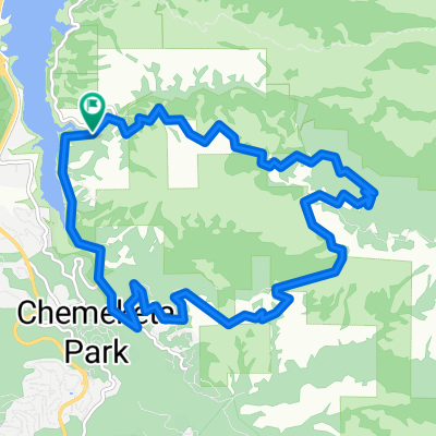
Low-Key Hillclimb of Soda Springs Road from bottom of road to gate
- -:--
- Duration
- 8.5 km
- Distance
- 766 m
- Ascent
- 69 m
- Descent
- ---
- Avg. speed
- ---
- Avg. speed

Route quality
Waytypes & surfaces along the route
Waytypes
Quiet road
8.5 km
(100 %)
Continue with Bikemap
Use, edit, or download this cycling route
You would like to ride Low-Key Hillclimb: Soda Springs Road or customize it for your own trip? Here is what you can do with this Bikemap route:
Free features
- Save this route as favorite or in collections
- Copy & plan your own version of this route
- Sync your route with Garmin or Wahoo
Premium features
Free trial for 3 days, or one-time payment. More about Bikemap Premium.
- Navigate this route on iOS & Android
- Export a GPX / KML file of this route
- Create your custom printout (try it for free)
- Download this route for offline navigation
Discover more Premium features.
Get Bikemap PremiumFrom our community
Other popular routes starting in Lexington Hills
 LosGatos->Soquel->Corallitos->BlackRd
- Distance
- 95.4 km
- Ascent
- 1,302 m
- Descent
- 1,278 m
- Location
- Lexington Hills, California, United States of America
 Lexington Reservoir Loop
- Distance
- 12.3 km
- Ascent
- 371 m
- Descent
- 370 m
- Location
- Lexington Hills, California, United States of America
 LosGatos->SantaCruz->Empire>Jameson->Hwy9
- Distance
- 123.7 km
- Ascent
- 2,054 m
- Descent
- 2,030 m
- Location
- Lexington Hills, California, United States of America
 Low-Key Hillclimb: Soda Springs Road
- Distance
- 8.5 km
- Ascent
- 766 m
- Descent
- 69 m
- Location
- Lexington Hills, California, United States of America
 Mt Umunhum Loop
- Distance
- 40.2 km
- Ascent
- 1,105 m
- Descent
- 1,105 m
- Location
- Lexington Hills, California, United States of America
 2724–2762 Mount Umunhum Rd, San Jose to 2724–2762 Mount Umunhum Rd, San Jose
- Distance
- 6.2 km
- Ascent
- 203 m
- Descent
- 206 m
- Location
- Lexington Hills, California, United States of America
 Soda Springs Loop
- Distance
- 15.5 km
- Ascent
- 536 m
- Descent
- 536 m
- Location
- Lexington Hills, California, United States of America
 Mount Umunhum Rd, San Jose to 15287 Top Of The Hill Ct, Los Gatos
- Distance
- 19.4 km
- Ascent
- 714 m
- Descent
- 881 m
- Location
- Lexington Hills, California, United States of America
Open it in the app