

Storchenroute - Nord
A cycling route starting in Raddestorf, Lower Saxony, Germany.
Overview
About this route
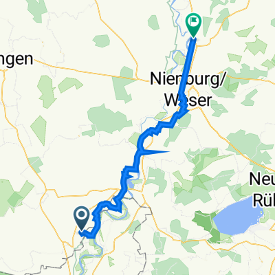
Von Hävern - Parkplatz an der alten Mühle - über Großenheerse nach Schlüsselburg, An der Staustufe über die Weser bis nach Windheim. In Windheim mit der Solarfähre "Petra Solara" - Fahrplan beachten - wieder zurück über die Weser und nach Hävern zum Parkplatz.
- -:--
- Duration
- 32.8 km
- Distance
- 31 m
- Ascent
- 33 m
- Descent
- ---
- Avg. speed
- ---
- Avg. speed

Route quality
Waytypes & surfaces along the route
Waytypes
Quiet road
17.1 km
(52 %)
Road
11.3 km
(35 %)
Surfaces
Paved
30.9 km
(94 %)
Unpaved
0.8 km
(3 %)
Asphalt
30.5 km
(93 %)
Loose gravel
0.5 km
(1 %)
Continue with Bikemap
Use, edit, or download this cycling route
You would like to ride Storchenroute - Nord or customize it for your own trip? Here is what you can do with this Bikemap route:
Free features
- Save this route as favorite or in collections
- Copy & plan your own version of this route
- Sync your route with Garmin or Wahoo
Premium features
Free trial for 3 days, or one-time payment. More about Bikemap Premium.
- Navigate this route on iOS & Android
- Export a GPX / KML file of this route
- Create your custom printout (try it for free)
- Download this route for offline navigation
Discover more Premium features.
Get Bikemap PremiumFrom our community
Other popular routes starting in Raddestorf
 Matjesroute
- Distance
- 18.6 km
- Ascent
- 48 m
- Descent
- 45 m
- Location
- Raddestorf, Lower Saxony, Germany
 Fronleichnam 2016
- Distance
- 59.4 km
- Ascent
- 48 m
- Descent
- 48 m
- Location
- Raddestorf, Lower Saxony, Germany
 Großenheerser Mühle 4, Petershagen nach Dorfstraße 18, Rohrsen
- Distance
- 46.8 km
- Ascent
- 31 m
- Descent
- 87 m
- Location
- Raddestorf, Lower Saxony, Germany
 Weserradweg - ADFC - Empfehlung 2011
- Distance
- 85.1 km
- Ascent
- 26 m
- Descent
- 49 m
- Location
- Raddestorf, Lower Saxony, Germany
 4. Etappe Lohmar/Hamburg
- Distance
- 87.3 km
- Ascent
- 121 m
- Descent
- 112 m
- Location
- Raddestorf, Lower Saxony, Germany
 Bückeburg-Wasserstraßenkreutz-Findlingsgarten
- Distance
- 85.5 km
- Ascent
- 159 m
- Descent
- 159 m
- Location
- Raddestorf, Lower Saxony, Germany
 Friedewalde
- Distance
- 18.2 km
- Ascent
- 31 m
- Descent
- 13 m
- Location
- Raddestorf, Lower Saxony, Germany
 Fähre Hävern - Fähre Schweringen
- Distance
- 57.4 km
- Ascent
- 26 m
- Descent
- 41 m
- Location
- Raddestorf, Lower Saxony, Germany
Open it in the app