

Pbg.-Uffing-Bad Kohlgrub-Pbg
A cycling route starting in Peißenberg, Bavaria, Germany.
Overview
About this route
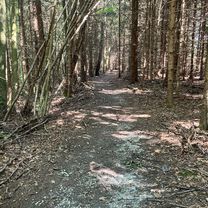
MTB Tour. Mit kurzen schwierigen Stellen sonst mit etwas Kondition fahrbar. Start ist die Ammerbrücke Wörth linksseitig der Ammer. Leider mußte ich wegen der Bahnbaustelle von Roßlaich nach Huglfing auf der Bundesstraße fahren.
- -:--
- Duration
- 58 km
- Distance
- 396 m
- Ascent
- 394 m
- Descent
- ---
- Avg. speed
- ---
- Avg. speed

Continue with Bikemap
Use, edit, or download this cycling route
You would like to ride Pbg.-Uffing-Bad Kohlgrub-Pbg or customize it for your own trip? Here is what you can do with this Bikemap route:
Free features
- Save this route as favorite or in collections
- Copy & plan your own version of this route
- Sync your route with Garmin or Wahoo
Premium features
Free trial for 3 days, or one-time payment. More about Bikemap Premium.
- Navigate this route on iOS & Android
- Export a GPX / KML file of this route
- Create your custom printout (try it for free)
- Download this route for offline navigation
Discover more Premium features.
Get Bikemap PremiumFrom our community
Other popular routes starting in Peißenberg
 Rund um den Hohen Peissenberg
- Distance
- 30.1 km
- Ascent
- 426 m
- Descent
- 428 m
- Location
- Peißenberg, Bavaria, Germany
 Zellerweg 12, Peißenberg nach Zellerweg 12, Peißenberg
- Distance
- 31.9 km
- Ascent
- 474 m
- Descent
- 478 m
- Location
- Peißenberg, Bavaria, Germany
 Tour zum Ausprobieren
- Distance
- 24.7 km
- Ascent
- 500 m
- Descent
- 490 m
- Location
- Peißenberg, Bavaria, Germany
 Peißenberg-Bad Bayersoien
- Distance
- 65.7 km
- Ascent
- 959 m
- Descent
- 954 m
- Location
- Peißenberg, Bavaria, Germany
 WM15 15, Peißenberg nach Wörther Straße 12A, Peißenberg
- Distance
- 17.1 km
- Ascent
- 219 m
- Descent
- 197 m
- Location
- Peißenberg, Bavaria, Germany
 Grubsee
- Distance
- 47 km
- Ascent
- 548 m
- Descent
- 545 m
- Location
- Peißenberg, Bavaria, Germany
 Mtb Runde von Peißenberg, Carl-Benz-Straße, über Ammerhöfe, runter zur Ammer und zurück
- Distance
- 18.3 km
- Ascent
- 261 m
- Descent
- 265 m
- Location
- Peißenberg, Bavaria, Germany
 jakob giessrunde
- Distance
- 6.7 km
- Ascent
- 8 m
- Descent
- 8 m
- Location
- Peißenberg, Bavaria, Germany
Open it in the app