

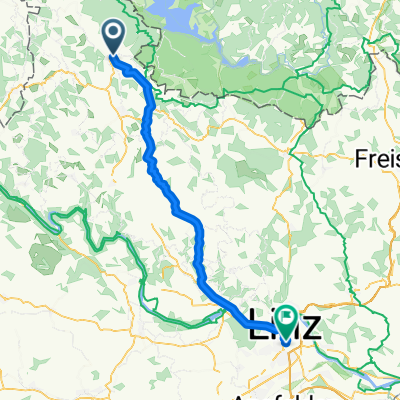
Aigen/Schlägl über Obermühl, Feldkirchen bis Linz
A cycling route starting in Schlägl, Upper Austria, Austria.
Overview
About this route
Mühlkreisbahn 7:30 ab Linz, 9:07 an Aigen / Schlägl.
Mühlradweg von Aigen / Schlägl bis Obermühl. Donauradweg auf Nordseite bis Untermühl (Google Earth scheint dies nicht zu akzeptieren). In Untermühl mit Längsfähre ca. 5km und weiter auf Nordseite bis Linz. Auch in Linz kennt Google Earth den Donauradweg nicht und führt über die Straße.
- -:--
- Duration
- 75.3 km
- Distance
- 898 m
- Ascent
- 1,178 m
- Descent
- ---
- Avg. speed
- 681 m
- Avg. speed

Route quality
Waytypes & surfaces along the route
Waytypes
Quiet road
33.3 km
(44 %)
Busy road
24.1 km
(32 %)
Surfaces
Paved
57 km
(76 %)
Unpaved
0.5 km
(<1 %)
Asphalt
56.9 km
(76 %)
Ground
0.5 km
(<1 %)
Continue with Bikemap
Use, edit, or download this cycling route
You would like to ride Aigen/Schlägl über Obermühl, Feldkirchen bis Linz or customize it for your own trip? Here is what you can do with this Bikemap route:
Free features
- Save this route as favorite or in collections
- Copy & plan your own version of this route
- Sync your route with Garmin or Wahoo
Premium features
Free trial for 3 days, or one-time payment. More about Bikemap Premium.
- Navigate this route on iOS & Android
- Export a GPX / KML file of this route
- Create your custom printout (try it for free)
- Download this route for offline navigation
Discover more Premium features.
Get Bikemap PremiumFrom our community
Other popular routes starting in Schlägl
 2010-Tag26: Furthmühle-Passau
- Distance
- 80.7 km
- Ascent
- 433 m
- Descent
- 643 m
- Location
- Schlägl, Upper Austria, Austria
 Haslach
- Distance
- 47.8 km
- Ascent
- 884 m
- Descent
- 881 m
- Location
- Schlägl, Upper Austria, Austria
 Ameisbergrunde
- Distance
- 44.5 km
- Ascent
- 1,029 m
- Descent
- 1,027 m
- Location
- Schlägl, Upper Austria, Austria
 2010-Tag25: Runde um die Furthmühle
- Distance
- 7.8 km
- Ascent
- 200 m
- Descent
- 205 m
- Location
- Schlägl, Upper Austria, Austria
 2010 St Oswald/Furtmühle-Passau
- Distance
- 80.6 km
- Ascent
- 389 m
- Descent
- 603 m
- Location
- Schlägl, Upper Austria, Austria
 Rohrbach nach Wien 2017
- Distance
- 264.6 km
- Ascent
- 151 m
- Descent
- 555 m
- Location
- Schlägl, Upper Austria, Austria
 Haslach/Svaty Tomas/Stausee/Afiesl/Haslach
- Distance
- 45.9 km
- Ascent
- 0 m
- Descent
- 0 m
- Location
- Schlägl, Upper Austria, Austria
 Grüner Weg, Aigen-Schlägl nach Bahnhofplatz, Linz
- Distance
- 59.5 km
- Ascent
- 804 m
- Descent
- 1,110 m
- Location
- Schlägl, Upper Austria, Austria
Open it in the app