

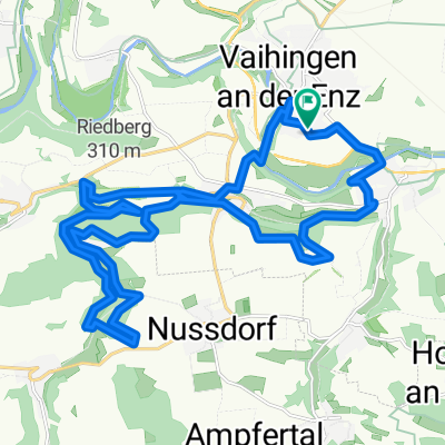
Enz - Neckar
A cycling route starting in Vaihingen an der Enz, Baden-Württemberg, Germany.
Overview
About this route
- -:--
- Duration
- 73.9 km
- Distance
- 316 m
- Ascent
- 318 m
- Descent
- ---
- Avg. speed
- ---
- Avg. speed

Route quality
Waytypes & surfaces along the route
Waytypes
Track
25 km
(34 %)
Quiet road
21.7 km
(29 %)
Surfaces
Paved
65.5 km
(89 %)
Unpaved
5.2 km
(7 %)
Asphalt
60.3 km
(82 %)
Concrete
3.4 km
(5 %)
Route highlights
Points of interest along the route
Point of interest after 24.8 km
Achtung weiterfahrt zum Neckar, hinter Aldi links hoch zum Damm hinweis Bootsanlegestelle
Point of interest after 25.1 km
Hier hinter Aldi gehts hoch zum Damm (Radweg)
Point of interest after 41.4 km
da geht der Radweg rechts hoch ein hiweis gerade aus geht zu einem Bauerhof.
Point of interest after 47.5 km
eine Baustelle wenn fertig,gerade aus weiter.
Continue with Bikemap
Use, edit, or download this cycling route
You would like to ride Enz - Neckar or customize it for your own trip? Here is what you can do with this Bikemap route:
Free features
- Save this route as favorite or in collections
- Copy & plan your own version of this route
- Sync your route with Garmin or Wahoo
Premium features
Free trial for 3 days, or one-time payment. More about Bikemap Premium.
- Navigate this route on iOS & Android
- Export a GPX / KML file of this route
- Create your custom printout (try it for free)
- Download this route for offline navigation
Discover more Premium features.
Get Bikemap PremiumFrom our community
Other popular routes starting in Vaihingen an der Enz
 Kleine Trainingsrunde
- Distance
- 18.8 km
- Ascent
- 200 m
- Descent
- 196 m
- Location
- Vaihingen an der Enz, Baden-Württemberg, Germany
 Rundtour Enzweihingen - Stromberg
- Distance
- 78.9 km
- Ascent
- 407 m
- Descent
- 404 m
- Location
- Vaihingen an der Enz, Baden-Württemberg, Germany
 Trainingsrunde
- Distance
- 33.6 km
- Ascent
- 237 m
- Descent
- 237 m
- Location
- Vaihingen an der Enz, Baden-Württemberg, Germany
 HW10 Eppinger Linie 45km
- Distance
- 44.8 km
- Ascent
- 402 m
- Descent
- 401 m
- Location
- Vaihingen an der Enz, Baden-Württemberg, Germany
 Kreuzbachroute Sonnenberg Großglattbach
- Distance
- 27.6 km
- Ascent
- 368 m
- Descent
- 366 m
- Location
- Vaihingen an der Enz, Baden-Württemberg, Germany
 Vaihingen-Gündelbach-Illingen-Vaihingen
- Distance
- 20 km
- Ascent
- 228 m
- Descent
- 207 m
- Location
- Vaihingen an der Enz, Baden-Württemberg, Germany
 Vaihingen/Enz, Weissach Rundtour
- Distance
- 34.4 km
- Ascent
- 602 m
- Descent
- 556 m
- Location
- Vaihingen an der Enz, Baden-Württemberg, Germany
 Rundtour Vaihingen/Enz-Pforzheim-Mühlacker
- Distance
- 90.2 km
- Ascent
- 722 m
- Descent
- 722 m
- Location
- Vaihingen an der Enz, Baden-Württemberg, Germany
Open it in the app