

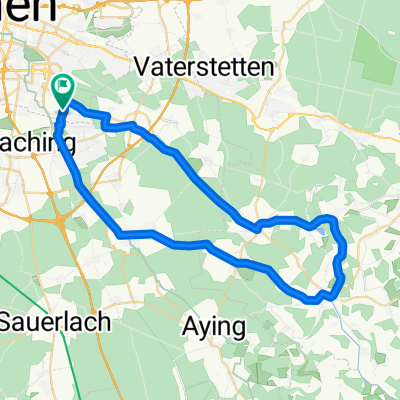
Waldperlach Irschenberg Seehamer See
A cycling route starting in Neubiberg, Bavaria, Germany.
Overview
About this route
- -:--
- Duration
- 101.2 km
- Distance
- 729 m
- Ascent
- 729 m
- Descent
- ---
- Avg. speed
- ---
- Avg. speed
Route quality
Waytypes & surfaces along the route
Waytypes
Road
42.2 km
(42 %)
Quiet road
41.2 km
(41 %)
Surfaces
Paved
99 km
(98 %)
Unpaved
0.2 km
(<1 %)
Asphalt
98.4 km
(97 %)
Paving stones
0.5 km
(<1 %)
Continue with Bikemap
Use, edit, or download this cycling route
You would like to ride Waldperlach Irschenberg Seehamer See or customize it for your own trip? Here is what you can do with this Bikemap route:
Free features
- Save this route as favorite or in collections
- Copy & plan your own version of this route
- Sync your route with Garmin or Wahoo
Premium features
Free trial for 3 days, or one-time payment. More about Bikemap Premium.
- Navigate this route on iOS & Android
- Export a GPX / KML file of this route
- Create your custom printout (try it for free)
- Download this route for offline navigation
Discover more Premium features.
Get Bikemap PremiumFrom our community
Other popular routes starting in Neubiberg
 Neuperlach - Solalinden
- Distance
- 12.2 km
- Ascent
- 73 m
- Descent
- 75 m
- Location
- Neubiberg, Bavaria, Germany
 Kloster Reutberg
- Distance
- 89.1 km
- Ascent
- 329 m
- Descent
- 326 m
- Location
- Neubiberg, Bavaria, Germany
 THE WALTHERS Waldperlach - Isar Runde 01
- Distance
- 34.7 km
- Ascent
- 72 m
- Descent
- 73 m
- Location
- Neubiberg, Bavaria, Germany
 Perlach - Kloster Andechs
- Distance
- 47.6 km
- Ascent
- 328 m
- Descent
- 187 m
- Location
- Neubiberg, Bavaria, Germany
 Seentour - München Ost
- Distance
- 26.3 km
- Ascent
- 26 m
- Descent
- 24 m
- Location
- Neubiberg, Bavaria, Germany
 Aying 50 km
- Distance
- 51.3 km
- Ascent
- 246 m
- Descent
- 228 m
- Location
- Neubiberg, Bavaria, Germany
 Route entlang der Isar und des Perlacher Forstes
- Distance
- 25.1 km
- Ascent
- 126 m
- Descent
- 126 m
- Location
- Neubiberg, Bavaria, Germany
 Glonn
Glonn- Distance
- 49.1 km
- Ascent
- 551 m
- Descent
- 553 m
- Location
- Neubiberg, Bavaria, Germany
Open it in the app