

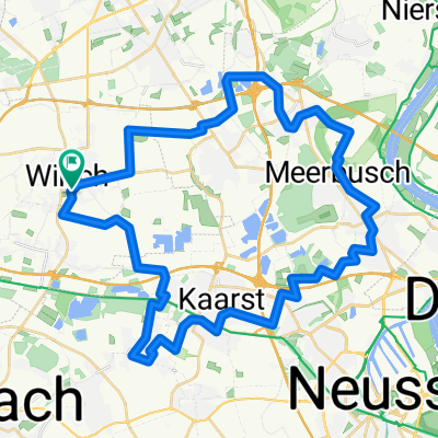
Niersradweg Teil 1 Willich - Wachtendonk
A cycling route starting in Willich, North Rhine-Westphalia, Germany.
Overview
About this route
- -:--
- Duration
- 32.5 km
- Distance
- 22 m
- Ascent
- 28 m
- Descent
- ---
- Avg. speed
- ---
- Avg. speed
Route quality
Waytypes & surfaces along the route
Waytypes
Path
19.8 km
(61 %)
Quiet road
8 km
(25 %)
Surfaces
Paved
20.9 km
(64 %)
Unpaved
11.4 km
(35 %)
Asphalt
20.5 km
(63 %)
Loose gravel
9.3 km
(29 %)
Route highlights
Points of interest along the route
Point of interest after 17.5 km
Aussichtspunkt
Point of interest after 18 km
Burg Uda
Point of interest after 25 km
Motte Horbes Bergske
Point of interest after 26.6 km
Abtei Mariendonk
Point of interest after 31.9 km
Burg Wachtendonk
Continue with Bikemap
Use, edit, or download this cycling route
You would like to ride Niersradweg Teil 1 Willich - Wachtendonk or customize it for your own trip? Here is what you can do with this Bikemap route:
Free features
- Save this route as favorite or in collections
- Copy & plan your own version of this route
- Sync your route with Garmin or Wahoo
Premium features
Free trial for 3 days, or one-time payment. More about Bikemap Premium.
- Navigate this route on iOS & Android
- Export a GPX / KML file of this route
- Create your custom printout (try it for free)
- Download this route for offline navigation
Discover more Premium features.
Get Bikemap PremiumFrom our community
Other popular routes starting in Willich
 Ruckes56
- Distance
- 54 km
- Ascent
- 50 m
- Descent
- 52 m
- Location
- Willich, North Rhine-Westphalia, Germany
 Willich - Kaiserswerth - Willich (Eiscafé in Meerbusch)
- Distance
- 43.4 km
- Ascent
- 64 m
- Descent
- 63 m
- Location
- Willich, North Rhine-Westphalia, Germany
 B09-Schlösser, Parks am Niedrrhein (ab Neersen-Dormagen)
- Distance
- 54.8 km
- Ascent
- 105 m
- Descent
- 102 m
- Location
- Willich, North Rhine-Westphalia, Germany
 Willich - Süchtelner Höhen - Willich
- Distance
- 40.3 km
- Ascent
- 103 m
- Descent
- 102 m
- Location
- Willich, North Rhine-Westphalia, Germany
 Süchtelner Höhen
- Distance
- 42.7 km
- Ascent
- 115 m
- Descent
- 115 m
- Location
- Willich, North Rhine-Westphalia, Germany
 Herrenhäuser Stockum - Clörath - Donk - Broich
- Distance
- 30 km
- Ascent
- 39 m
- Descent
- 38 m
- Location
- Willich, North Rhine-Westphalia, Germany
 ADFC NRWT 62L
- Distance
- 43.2 km
- Ascent
- 37 m
- Descent
- 40 m
- Location
- Willich, North Rhine-Westphalia, Germany
 Rundweg Willich
- Distance
- 39.4 km
- Ascent
- 24 m
- Descent
- 23 m
- Location
- Willich, North Rhine-Westphalia, Germany
Open it in the app